Lily Lake (12,385′), Sangre de Cristo Range
This trail is one of the more beautiful in the state with lots of bang for your buck. The trail starts out at 10,400 feet, hiking in an beautiful valley surrounded by huge mountain scenery, and is virtually flat. So if you don’t want to make the climb up to Lilly Lake you still have amazing views and really great creek fishing with lots of good camping options on the valley floor.
If you make the hike up, you can see Mt. Lindsey, Mt. Blanca, Mt. Ellingwood, and the Iron Nipple from Lilly Lake. From the Valley you can see all but Lindsey. Lilly Lake offers amazing views, an alpine environment just above treeline.
The Sangre de Cristo range has a wide range of remote and rugged hikes, such as Music Pass, South Colony Lakes, and Humboldt Peak .
Trail Stats
- Trailhead: Lily Lake TH #1308
- Round trip: 7.5 miles / 12 km
- Elevation: 10,400′ – 12,385′ / 3,170 m – 3,775 m
- County: Huerfano
- Wilderness: Sangre de Cristo

Trail Pictures

Mid-morning near the trailhead
Mid-morning near the trailhead

Blanca Peak (14,345′) in the far right distance
Blanca Peak (14,345′) in the far right distance

Meadow near the trailhead
Meadow near the trailhead

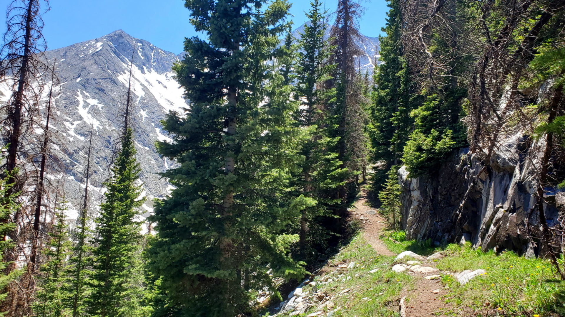
Rocky trail but well defined
Rocky trail but well defined

Snowmelt everywhere creating small waterfalls
Snowmelt everywhere creating small waterfalls

Mt Lindsey (14,042′) right of center
Mt Lindsey (14,042′) right of center
Last push to Lily Lake
Last push to Lily Lake

Lily Lake on top of the hill ahead
Lily Lake on top of the hill ahead
Incredible scenery along the trail
Incredible scenery along the trail

Snow quickly melting mid-June
Snow quickly melting mid-June

Ellingwood Point (14,042′) to the left of the lake
Ellingwood Point (14,042′) to the left of the lake

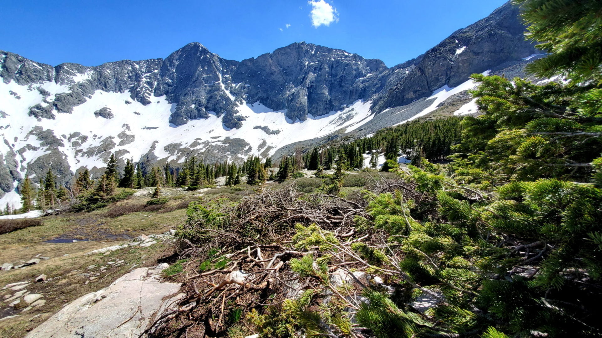
The view at treeline
The view at treeline

Shallow snow drifts along the trail
Shallow snow drifts along the trail

Turning west towards the lake
Turning west towards the lake

Lots of water crossings along the trail
Lots of water crossings along the trail

One of many waterfalls
One of many waterfalls

Spring snowmelt along the trail
Spring snowmelt along the trail

Beautiful scenery the entire way
Beautiful scenery the entire way
View south along the trail
View south along the trail

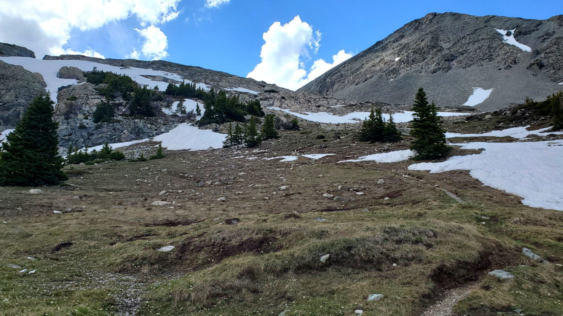
Avalanche area along the trail
Avalanche area along the trail

The trail follows Huerfano creek
The trail follows Huerfano creek
GPS Route with Elevation
Video Tour
Trail Directions
From the trailhead, follow clear signs to the Lily Lake Trail (there are no other trails at this TH). Head south and walk through a large meadow. From here, you can see the Blanca Massif straight ahead, with the Iron Nipple (13er) across the basin to its left. Hike one mile on mostly flat, clear terrain before coming to a trail junction with a sign for Lily Lake. Stay right (left will take you up Mt. Lindsey).
Continue up through the forest on excellent trail. You’ll continue to gain little elevation – just 1,500 ft over almost 3 miles from this point on. For most of the hike, Huerfano River will be on your left. At about 3 miles from the trailhead, at 11,600 ft, cross it and come to a large clearing with some boulders ahead and to your right. Loop up and back to your right, dipping briefly back into the forest. Just before the lake you come to a headwall just below the lake. Continue up and reach the lake at around 12,385 ft.
Trailhead Directions