Black Canyon of the Gunnison N.P. (8,500′)
The Black Canyon of the Gunnison park contains 12 miles (19 km) of the 48-mile (77 km) long Black Canyon of the Gunnison River. The national park contains the deepest and most dramatic section of the canyon. The canyon’s name comes from the long shadows, where portions of the gorge only receive 1/2 hr of sunlight a day.
The park has a north and south rim, with the south rim being the most popular. The South Rim Road runs along the edge of the the canyon, being a little over 8 miles long with 12 viewpoints. The viewpoints showcase some of the world’s oldest exposed rock, Precambrian or “basement” rock that is nearly 2 billion years old.
Intresting stats:
Painted Wall – 2,250′ – tallest cliff in Colorado
The Narrows – 40′ wide
Chasm View – narrowest point on the rim – 1,100′ wide
Warner Point – deepest point – 2,722′
Dogs are allowed in the park at all the overlooks. However, the canyon below the rim is designated a wilderness area, where dogs are not allowed.
Trail Stats
- Trailhead: Hwy 347 (South Rim)
- Round trip: 16.7 miles / 26.9 km
- Elevation: 8,500′- 6,200′ / 2,591 m – 1,890 m
- County: Montrose
- Agency: National Park Service
- Nat’l Park: Black Canyon of the Gunnison
- Wilderness: Gunnison Gorge Wilderness (below canyon rim)

Trail Pictures

South Rim entrance
South Rim entrance

A weather tested Juniper near the rim
A weather tested Juniper near the rim

Cedar Point Overlook
Cedar Point Overlook

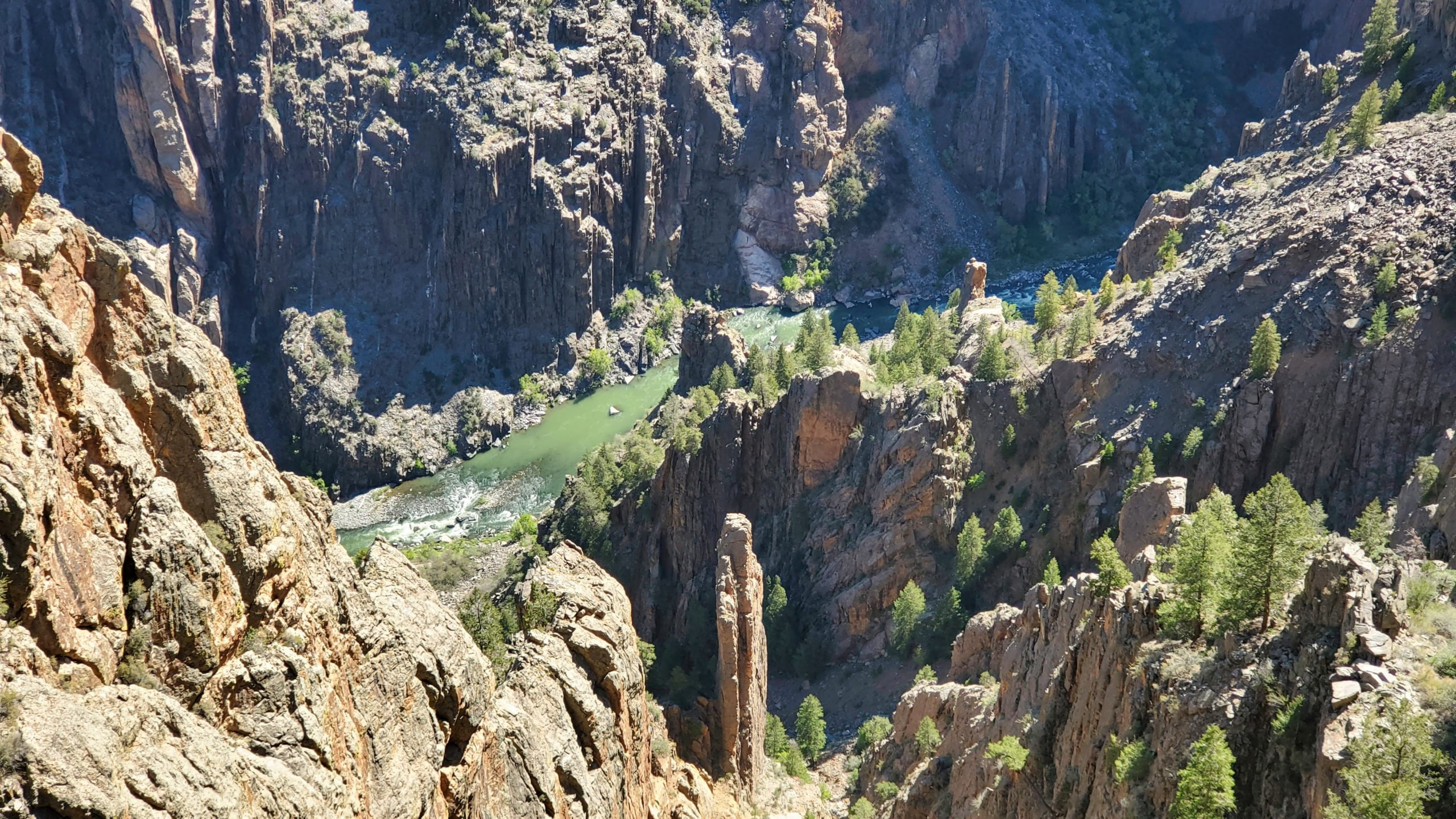
View of the Gunnison River from Cedar Point overlook
View of the Gunnison River from Cedar Point overlook
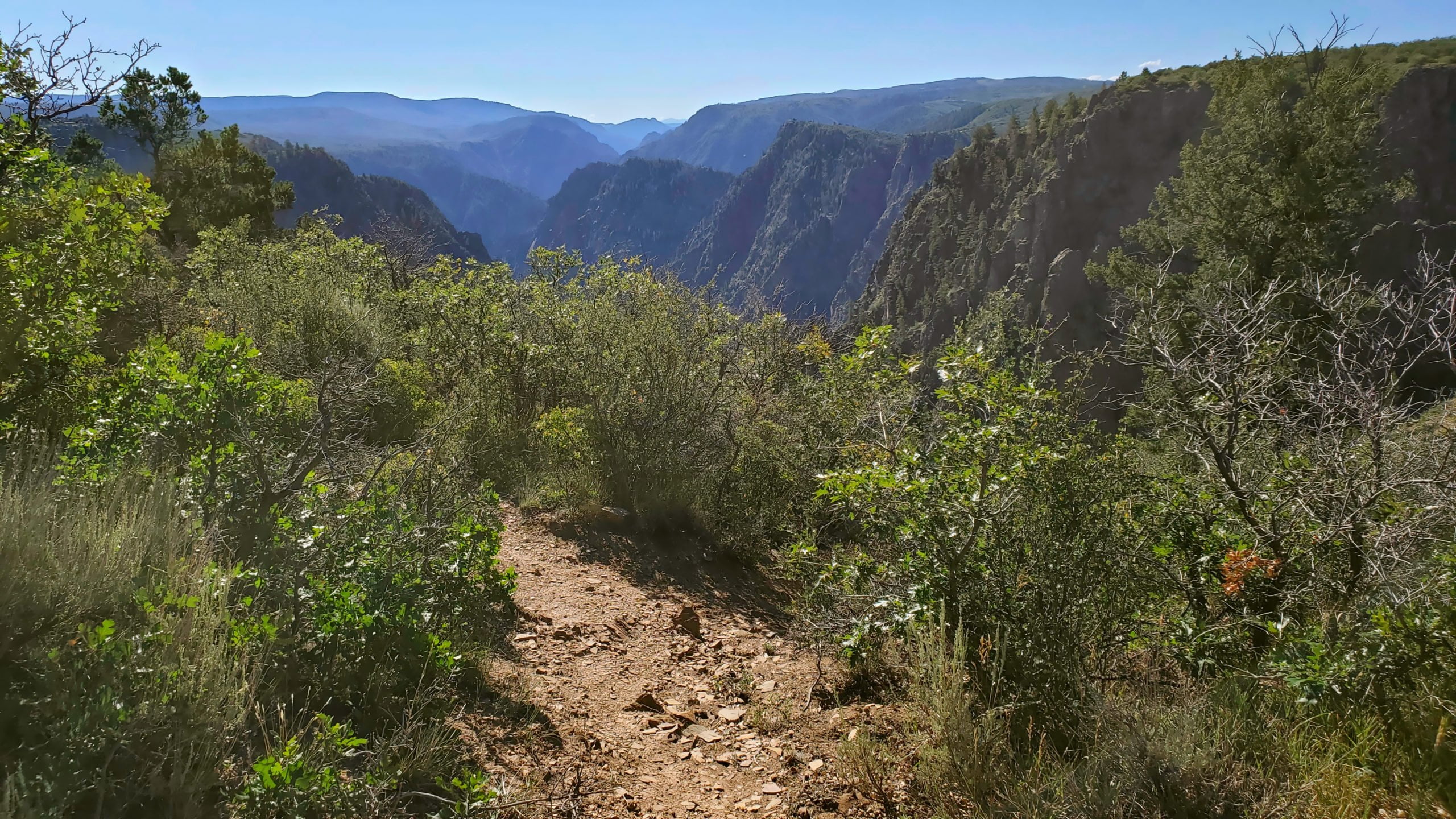
Rim Rock trail
Rim Rock trail

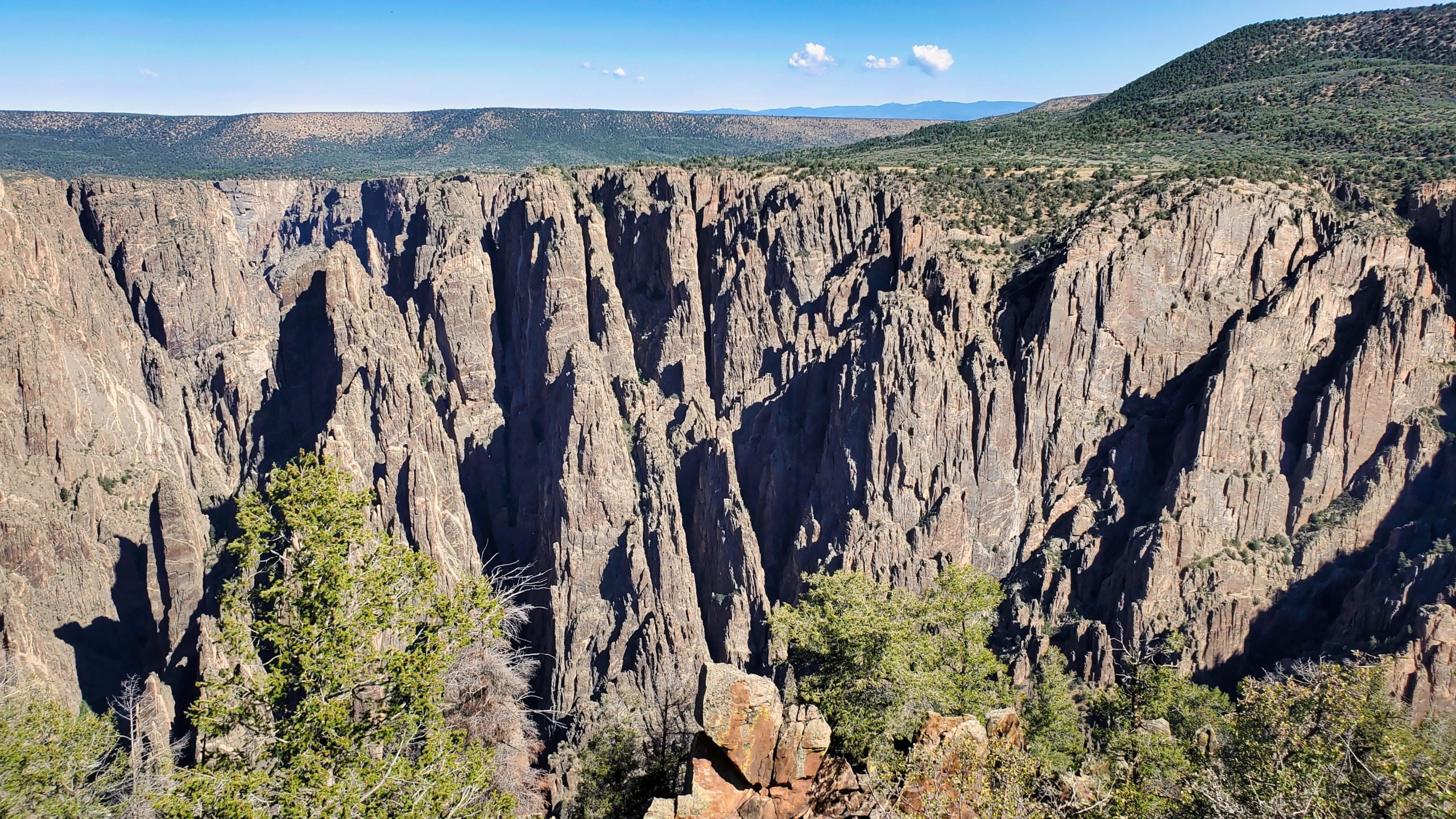
The park contains 12 miles of the 48 mile canyon
The park contains 12 miles of the 48 mile canyon

Typical trail conditions to the overlooks
Typical trail conditions to the overlooks

Only 30 minutes of sunlight reach parts of the inner canyon
Only 30 minutes of sunlight reach parts of the inner canyon

Sunset View Overlook
Sunset View Overlook

View near High Point overlook
View near High Point overlook

Painted Wall overlook view
Painted Wall overlook view

Close up of the Painted Wall
Close up of the Painted Wall

Gunnison River from Painted View overlook
Gunnison River from Painted View overlook

View from the Tomichi Point area
View from the Tomichi Point area

At it’s most narrow point, the canyon is only 40″ wide at the bottom
At it’s most narrow point, the canyon is only 40″ wide at the bottom

Over 2,500′ straight down
Over 2,500′ straight down

View of the North Rim
View of the North Rim
Some of the rock in the canyon is over 2 billion years old
Some of the rock in the canyon is over 2 billion years old

There are no trails to the bottom, only suggested routes
There are no trails to the bottom, only suggested routes
The Black Canyon of the Gunnison is an International Dark Sky Park
The Black Canyon of the Gunnison is an International Dark Sky Park

Gunnison Point next to the South Rim visitors center
Gunnison Point next to the South Rim visitors center

View of the canyon as it winds its way to the southeast
View of the canyon as it winds its way to the southeast
GPX with Elevation
Video Tour
Trail Directions
There are two primary entrances to the park: the south rim entrance is located 15 miles (24 km) east of Montrose, while the north rim entrance is 11 miles (18 km) south of Crawford and is closed in the winter. The park contains 12 miles (19 km) of the 48-mile (77 km) long Black Canyon of the Gunnison River. The national park itself contains the deepest and most dramatic section of the canyon, but the canyon continues upstream into Curecanti National Recreation Area and downstream into Gunnison Gorge National Conservation Area.
Trailhead Directions