Alpine Loop (12,800′), San Juan Range
The Alpine Loop Backcountry Byway is a rugged 4×4 road that winds through the spectacular scenery of the San Juan Mountains, connecting Lake City, Silverton, and Ouray. The loop traverses passes up to 12,800 feet while showcasing old mines, ghost towns, natural wonders, beautiful wildflowers, and abundant wildlife. Take a 10 minute detour while on the way to Cinnamon Pass to treat yourself to American Basin, one of the most beautiful places in Colorado.
Tackling the loop in its entirety is easily an all-day adventure. However, the main loop is only part of the experience; miles of designated side routes allow visitors to either take a short tour or extend their trip to multiple days. Hurricane (12,730′) and California Pass (12,960′) are two such examples that take you north from the Alpine Loop. For something closer to Lake City, tackle Wager Gulch to the Continental Divide.
Trail Stats
- Trailhead: Lake City
- Round trip: 65 miles / 105 km (moderate difficulty)
- Elevation: 9,000′ – 12,800′ / 2,743 m – 3,902 m
- County: San Juan / Hinsdale
- National Forest: San Juan
- Wilderness: Uncompahgre

Trail Pictures

Lake San Cristobal
Lake San Cristobal

County Road 30 heading southwest
County Road 30 heading southwest

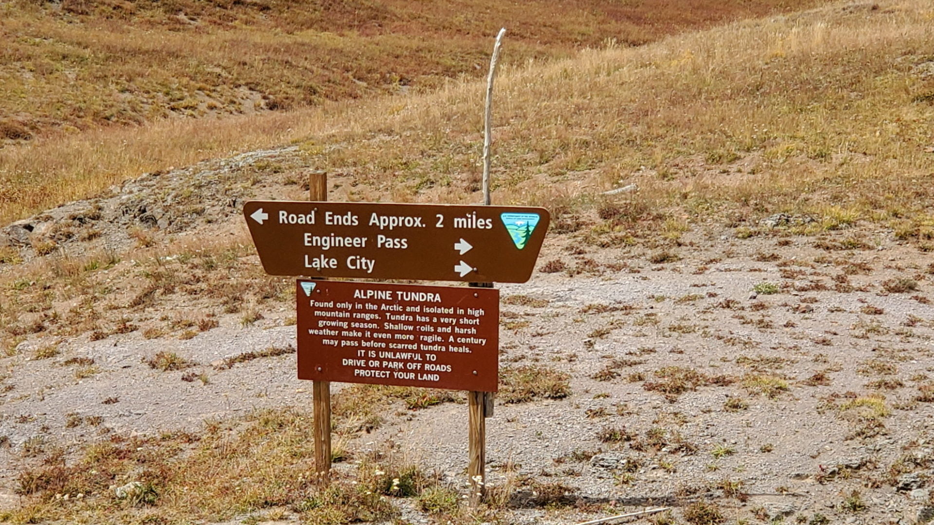
Alpine Loop sign on County Road 30
Alpine Loop sign on County Road 30

Valley along County Road 30
Valley along County Road 30

Sherman Overlook
Sherman Overlook

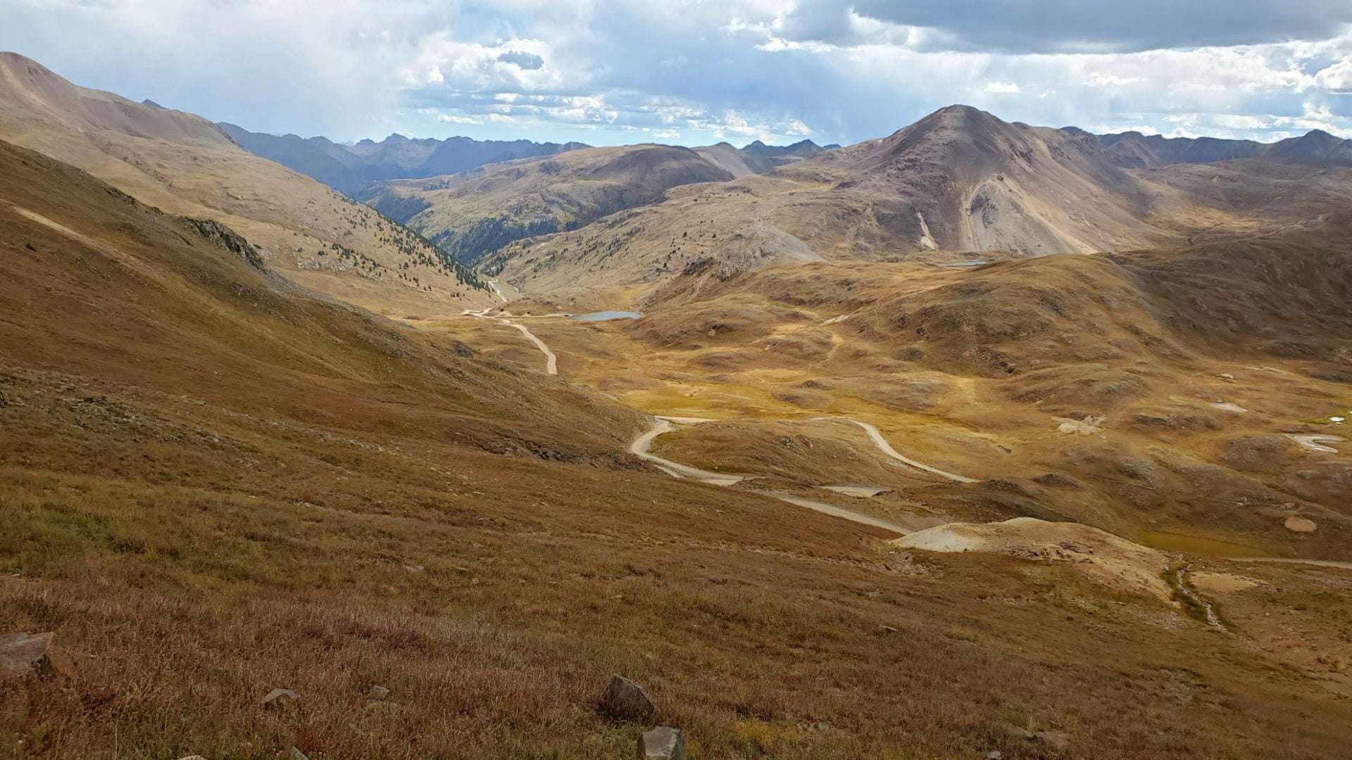
Heading toward American Basin
Heading toward American Basin

Sign for three 14’ers
Sign for three 14’ers

Heading northwest on CR30
Heading northwest on CR30

10 minute drive off the Alpine Loop to American Basin
10 minute drive off the Alpine Loop to American Basin

Gaining elevation to treeline
Gaining elevation to treeline

Looking back at the route up CR30
Looking back at the route up CR30

Cinnamon Pass 12,640′
Cinnamon Pass 12,640′

Heading north
Heading north

Above Animas Forks
Above Animas Forks
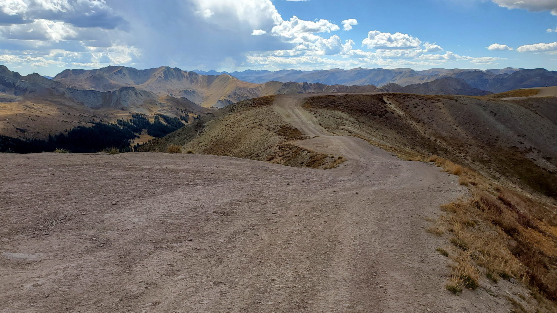
Heading to Engineer Pass
Heading to Engineer Pass

Climbing to Engineer Pass
Climbing to Engineer Pass
Turning east to Engineer Pass
Turning east to Engineer Pass
Looking back at County Road 20
Looking back at County Road 20

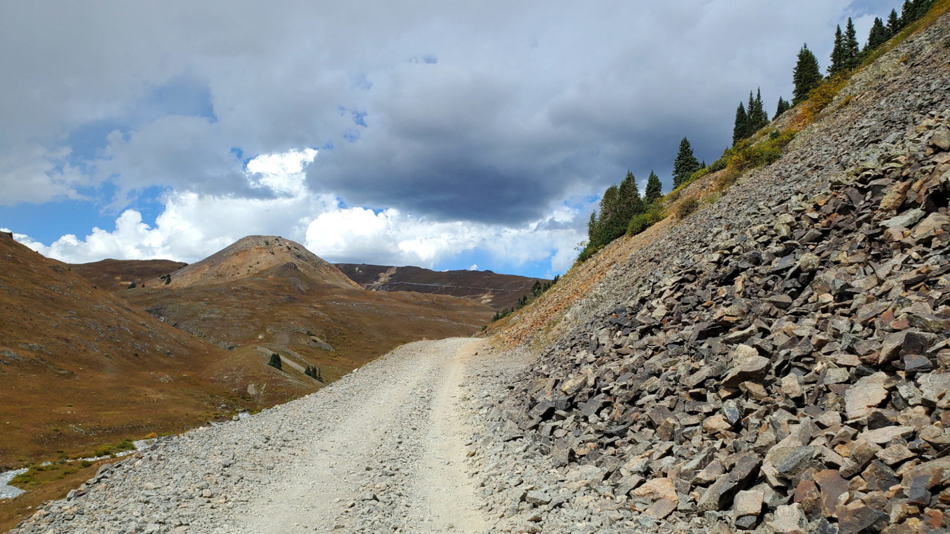
Variable conditions on the ledge road
Variable conditions on the ledge road

Nearing Engineer Pass
Nearing Engineer Pass

View near Engineer Pass
View near Engineer Pass
Just west of the pass
Just west of the pass

The final push to the pass
The final push to the pass
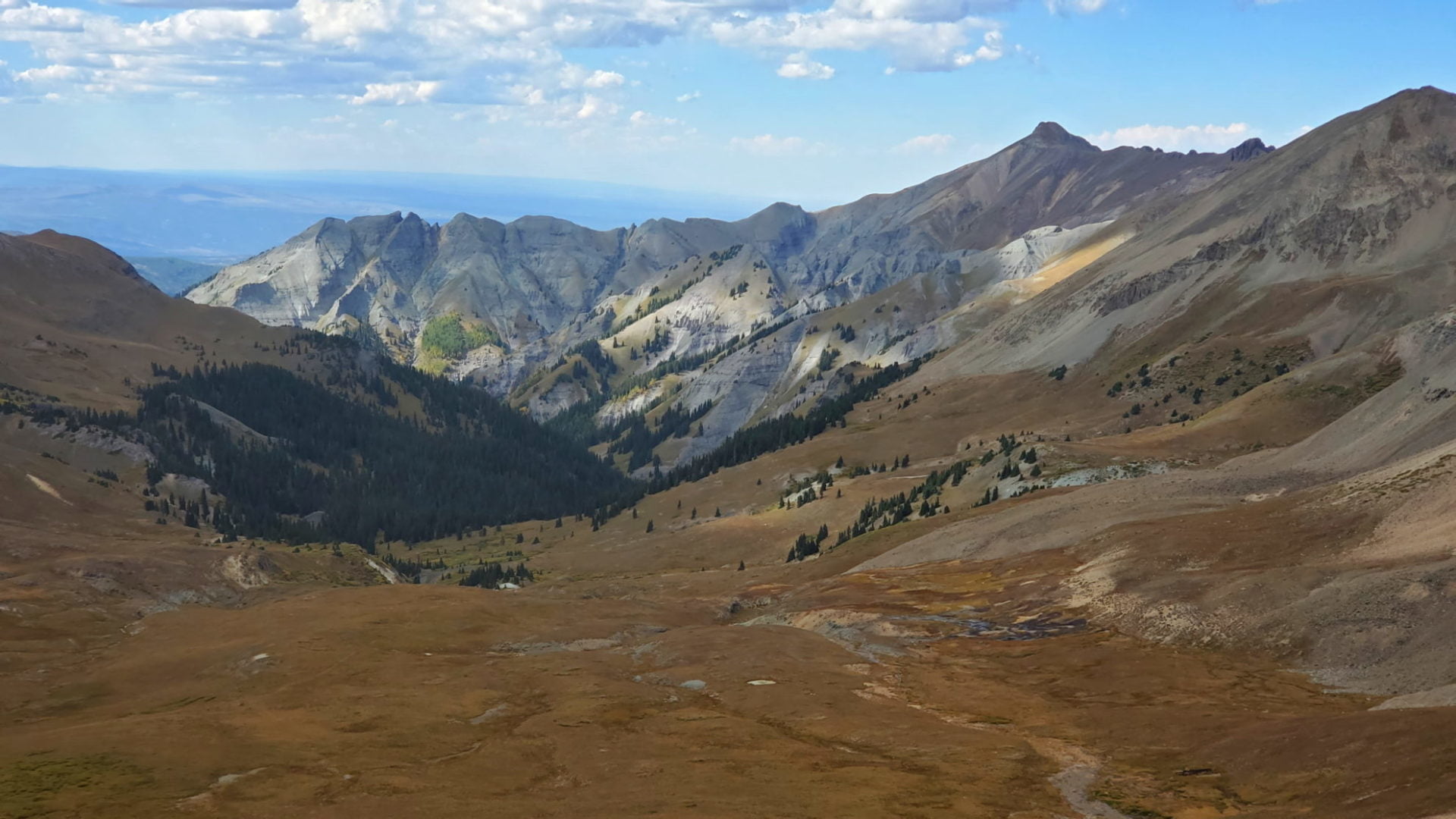
View from Engineer Pass
View from Engineer Pass

County Road 20 heading east
County Road 20 heading east
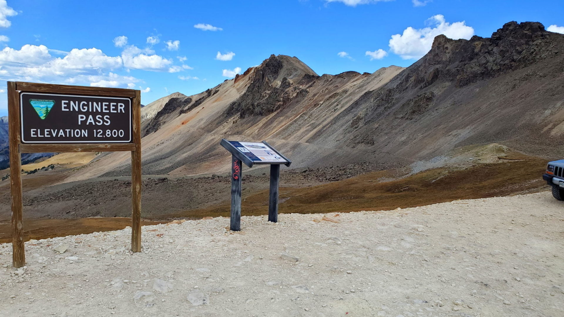
Engineer Pass 12,800′
Engineer Pass 12,800′

Darley Mountain on the right
Darley Mountain on the right

Views in all directions
Views in all directions

Old cabin high in the San Juans
Old cabin high in the San Juans

Heading east down County Road 20
Heading east down County Road 20

Fall in full force at higher elevations
Fall in full force at higher elevations

County Road 20
County Road 20

Nearing Lake City
Nearing Lake City

Cliff walls along County road 20 near Lake City
Cliff walls along County road 20 near Lake City
GPS Route with Elevation
Video Tour
Trail Directions
Tucked away in the San Juan Mountains of southwestern Colorado is the Alpine Loop National Backcountry Byway. Located northeast of Silverton, Colorado in San Juan and Hinsdale Counties, the circular route makes its way from Lake City south along CO-149, to County Road 30, which turns west over Cinnamon Pass (12,640 feet) to Animas Forks, and then returns east over Engineer Pass (12,800) back to Lake City along County Road 20. The loop is best traveled in a clockwise direction.
From Lake City enter the Alpine Loop on either County Road 30 or County Road 20. From Silverton enter the Alpine Loop on County Road 2. From Ouray enter the Alpine Loop on County Road 18.
Trailhead Directions