Hurricane Pass (12,730′) and California Pass (12,960′), San Juan Range
The National Water and Climate Center reported that the SWE (snow water equivalent) for the San Juan Mountains, including Hurricane Pass and California Pass, in May of 2019 was 728% above normal. It was such a heavy snow year that most of the back country at higher elevations was still buried in July. The heavy amounts of snow also caused a significant number of avalanches in the state. The only option out of Silverton to the Alpine Loop this July was to take SH 100 to Gladstone. Heavy avalanche debris still blocked the route to Animas Forks from Silverton using County Rd. 2.
Heading out of Silverton on SH 110, you pass Gladstone, which sits in a flat meadow where the five forks of Cement Creek meet. The town began in the late 1870’s from the surrounding mines including a sawmill just below the town site. As the mines grew, the sawmill was needed by other mines in the area, so a wagon road was graded up Cement Creek. In 1879 this wagon road went over Hurricane Pass and down Poughkeepsie Gulch as the route from Silverton to Ouray.
Today Poughkeepsie Gulch is generally for high clearance 4×4 vehicles that don’t mind a few road scars. The route today includes Hurricane and California Pass, and eventually leads down to Animas Forks.
The San Juan Mountains offer incredible outdoor beauty, including areas such as the Alpine Loop, American Basin, Mt Sneffels, and Stony Pass.
Trail Stats
- Road: SH 110, CR 10
- Round trip: 20.6 miles / 33.1 km
- Elevation: 9,318′ – 12,960′ / 2,840 m – 3,950 m
- County: San Juan
- Agency: U.S. Forest Service
- Nat’l Forest: San Juan

Trail Pictures

Traffic jam near Silverton
Traffic jam near Silverton
Snow easing up as we loose elevation
Snow easing up as we loose elevation
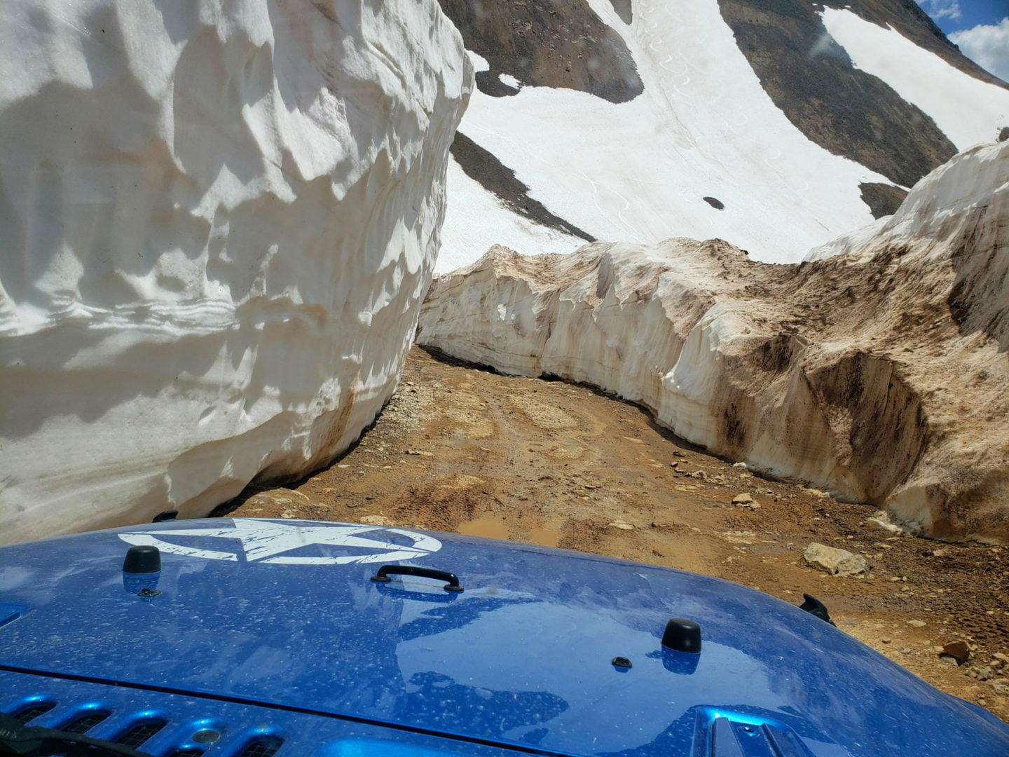
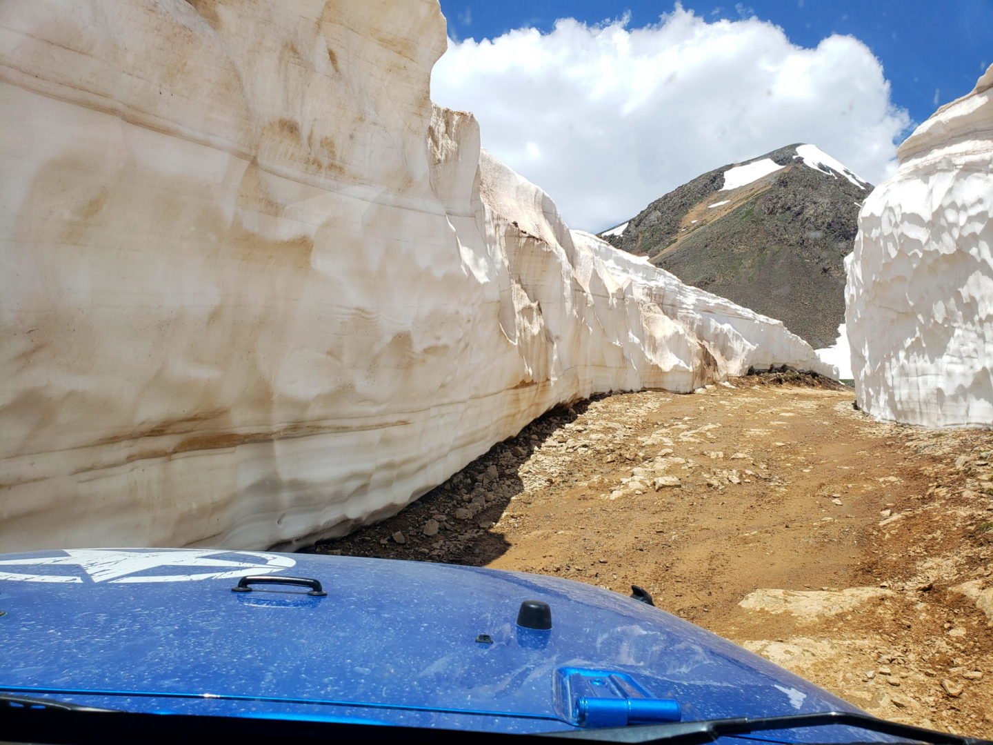
Very narrow through much of the upper road
Very narrow through much of the upper road
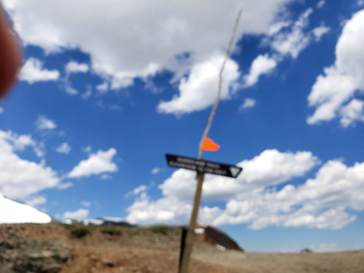
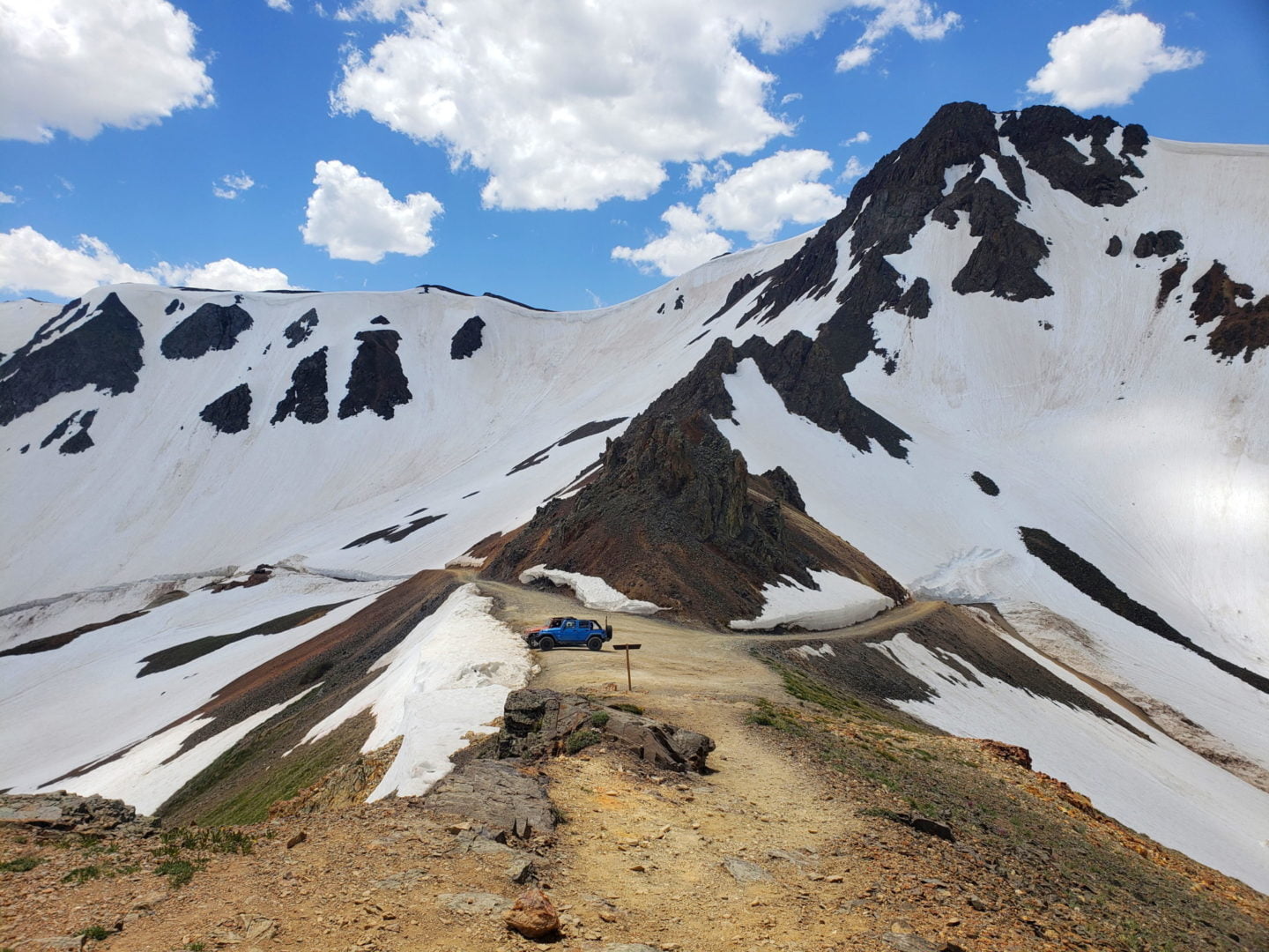
Hurricane Pass, 12,674′, blew me away
Hurricane Pass, 12,674′, blew me away
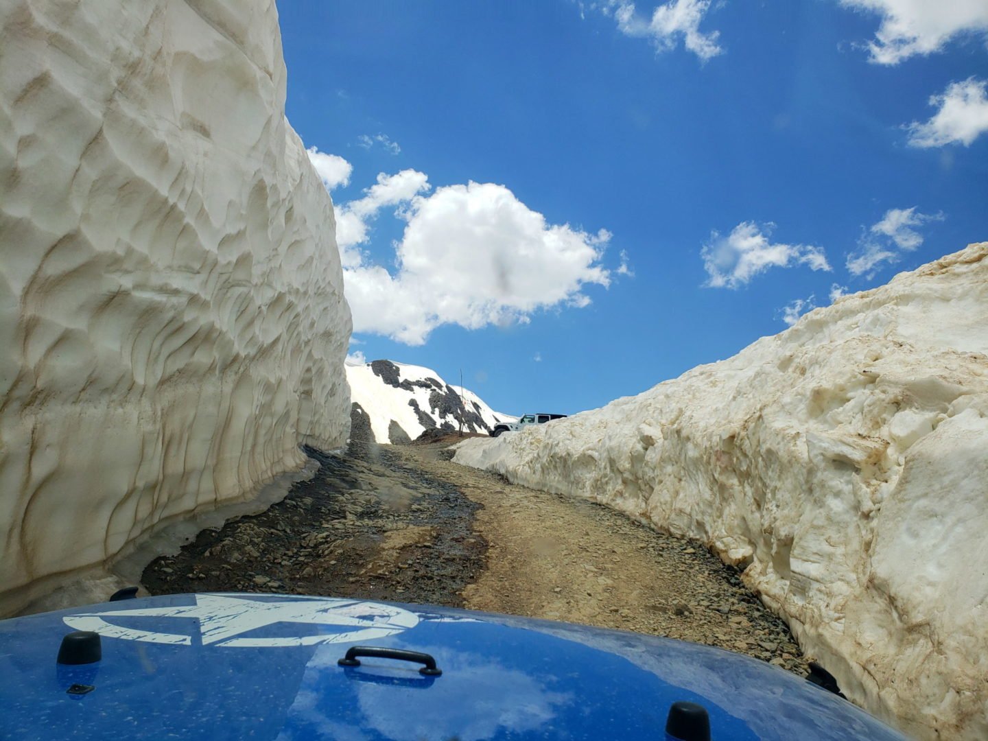
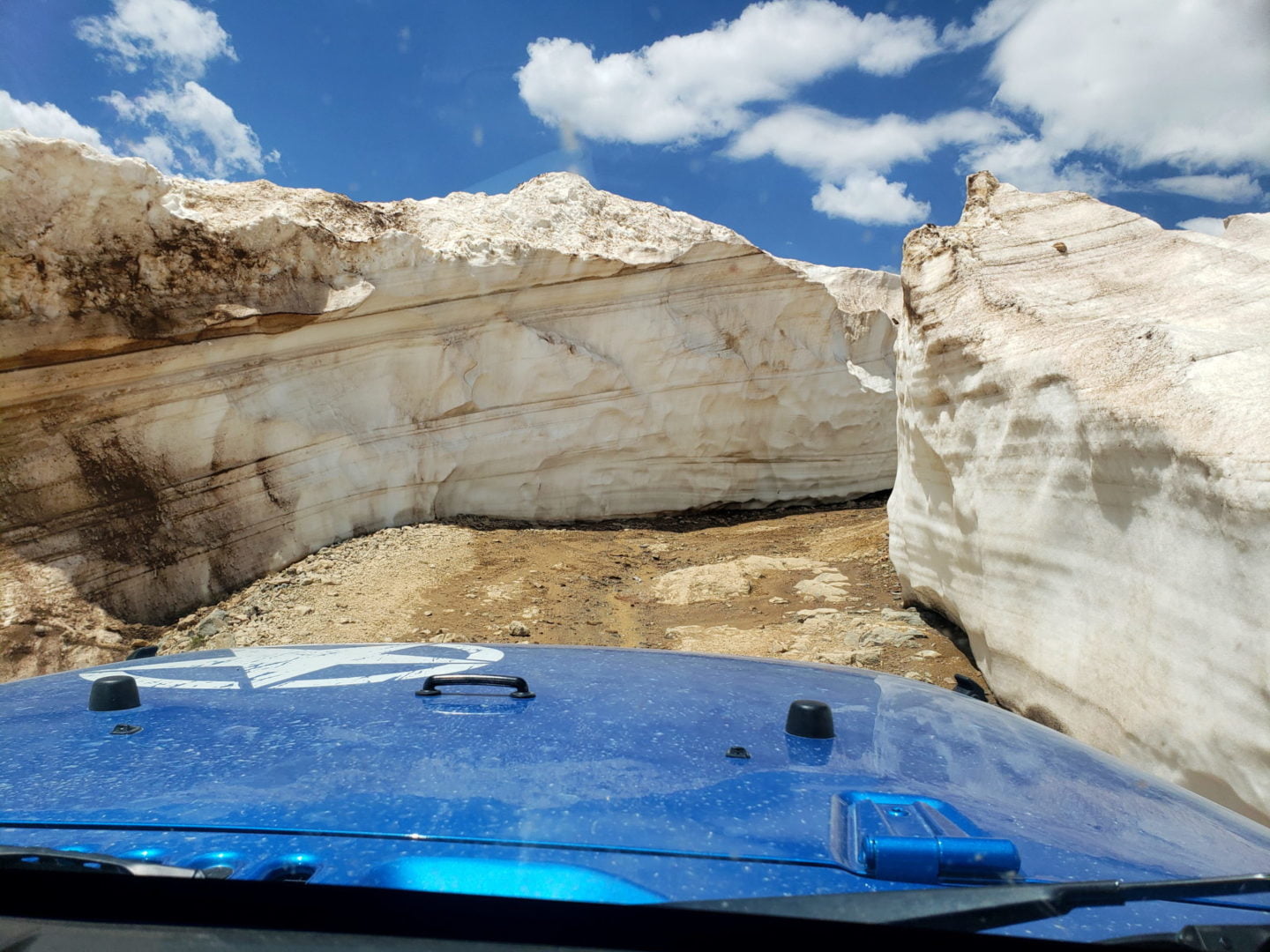
The towering walls of snow
The towering walls of snow
California Pass, 12,960′
California Pass, 12,960′

Tuttle Mountain ridgeline from California Pass
Tuttle Mountain ridgeline from California Pass
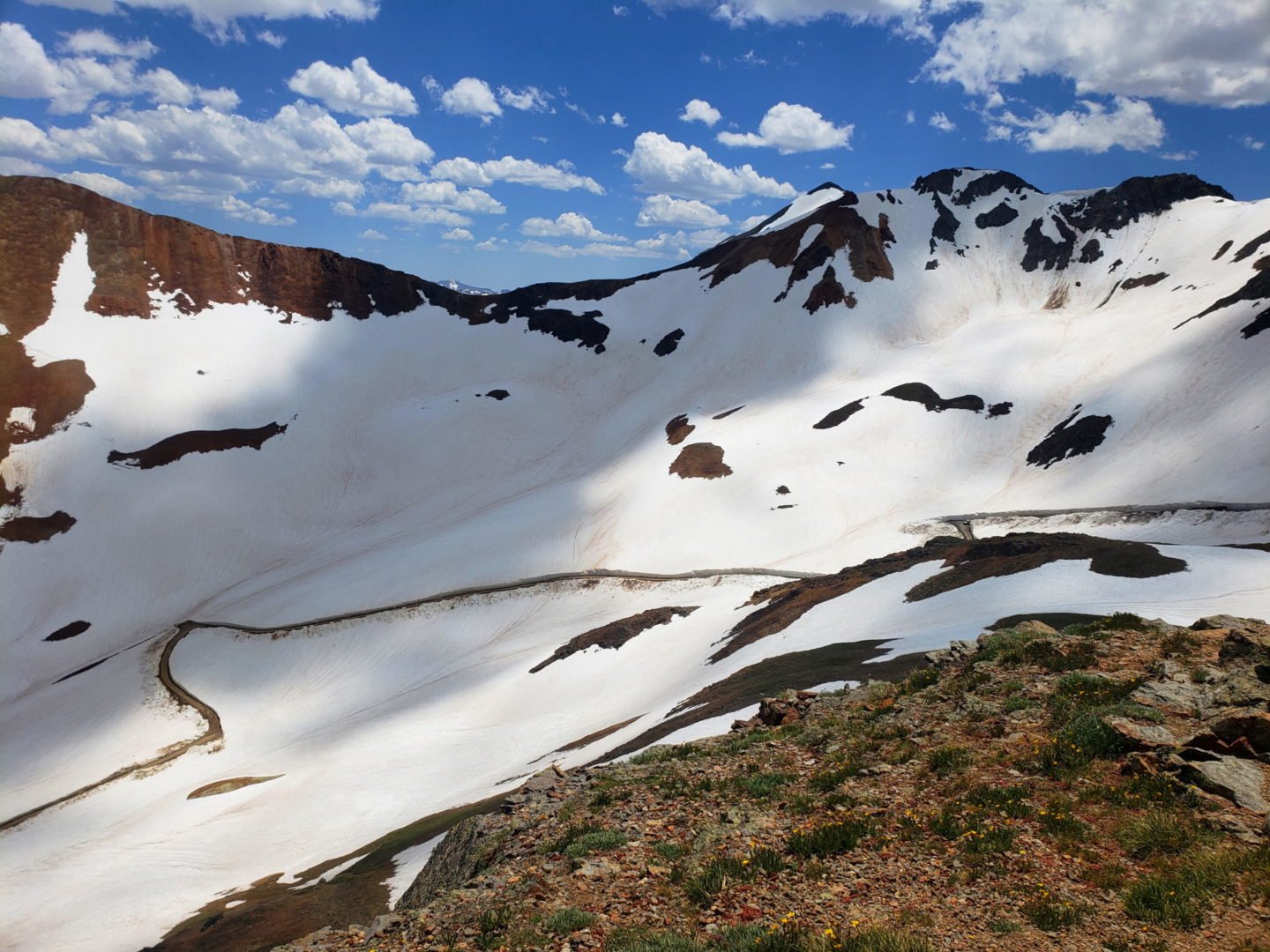
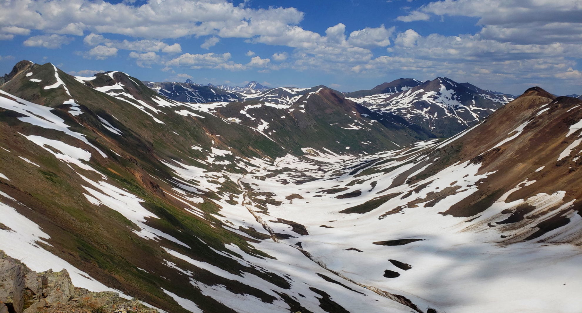
View toward Hurricane Pass from California Pass, with frozen Como Lake below
View toward Hurricane Pass from California Pass, with frozen Como Lake below

A beautiful day, warm and and calm winds
A beautiful day, warm and and calm winds
View of Hurricane Peak rising above CR10
View of Hurricane Peak rising above CR10

California Pass, 12,960′
California Pass, 12,960′

Near the summit of California Pass
Near the summit of California Pass
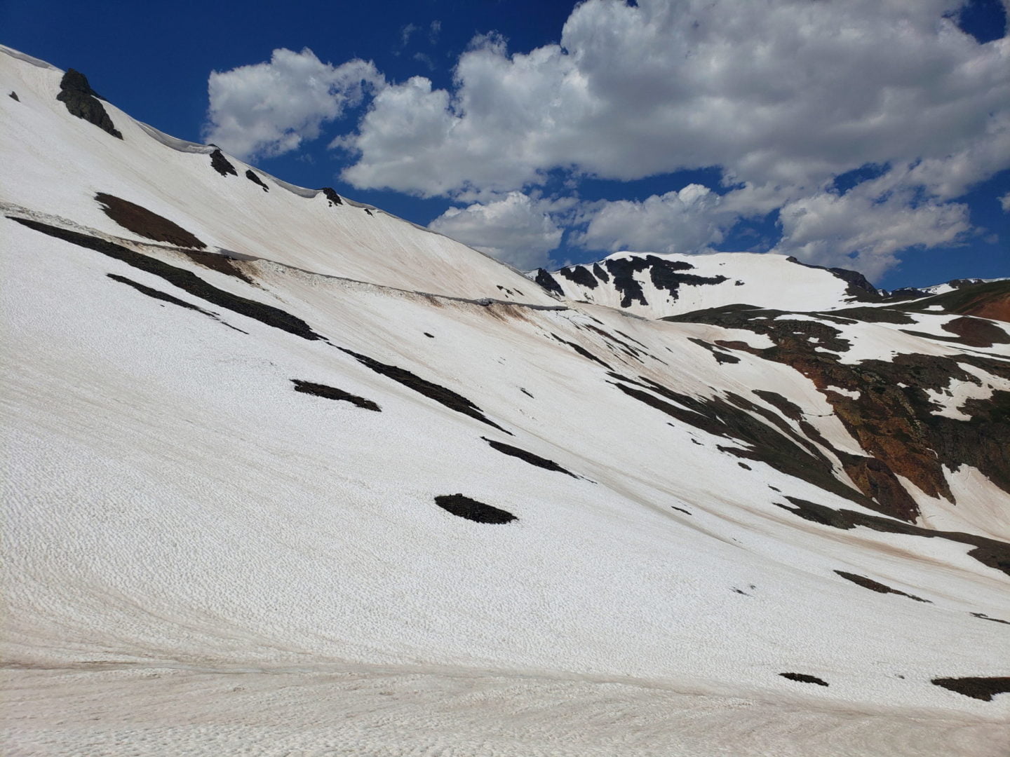
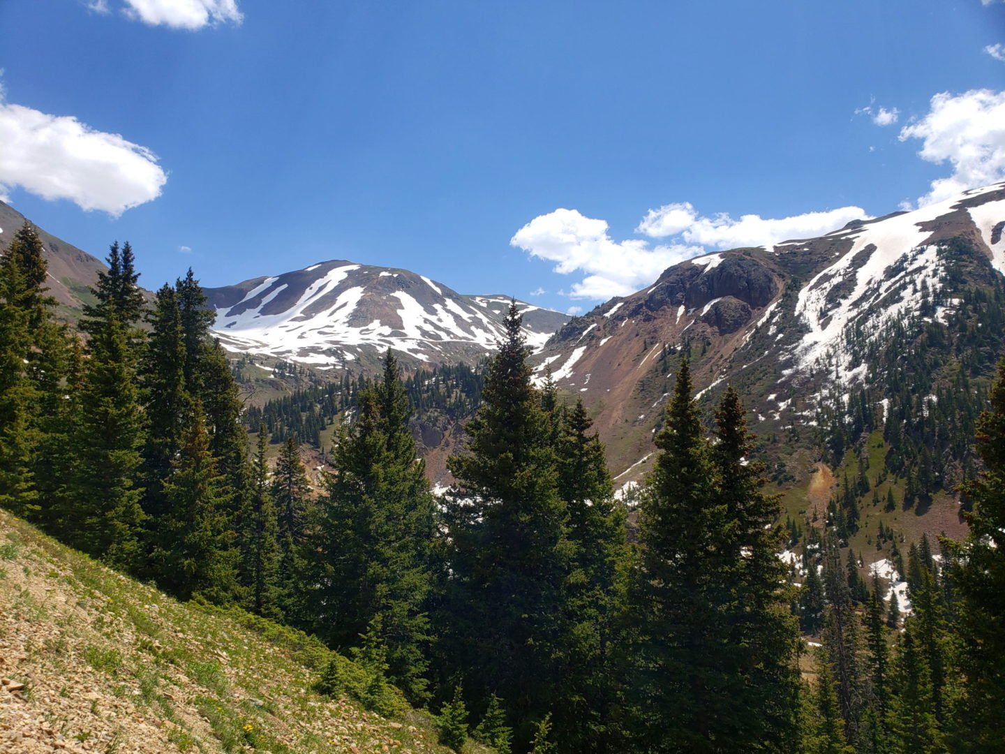
Extensive snow coverage in early July
Extensive snow coverage in early July
Heading up to California Pass
Heading up to California Pass
Looking back at CR10 near Hurricane Pass
Looking back at CR10 near Hurricane Pass
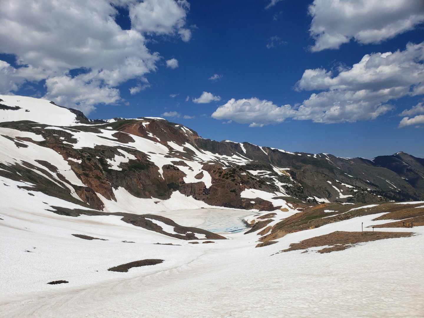
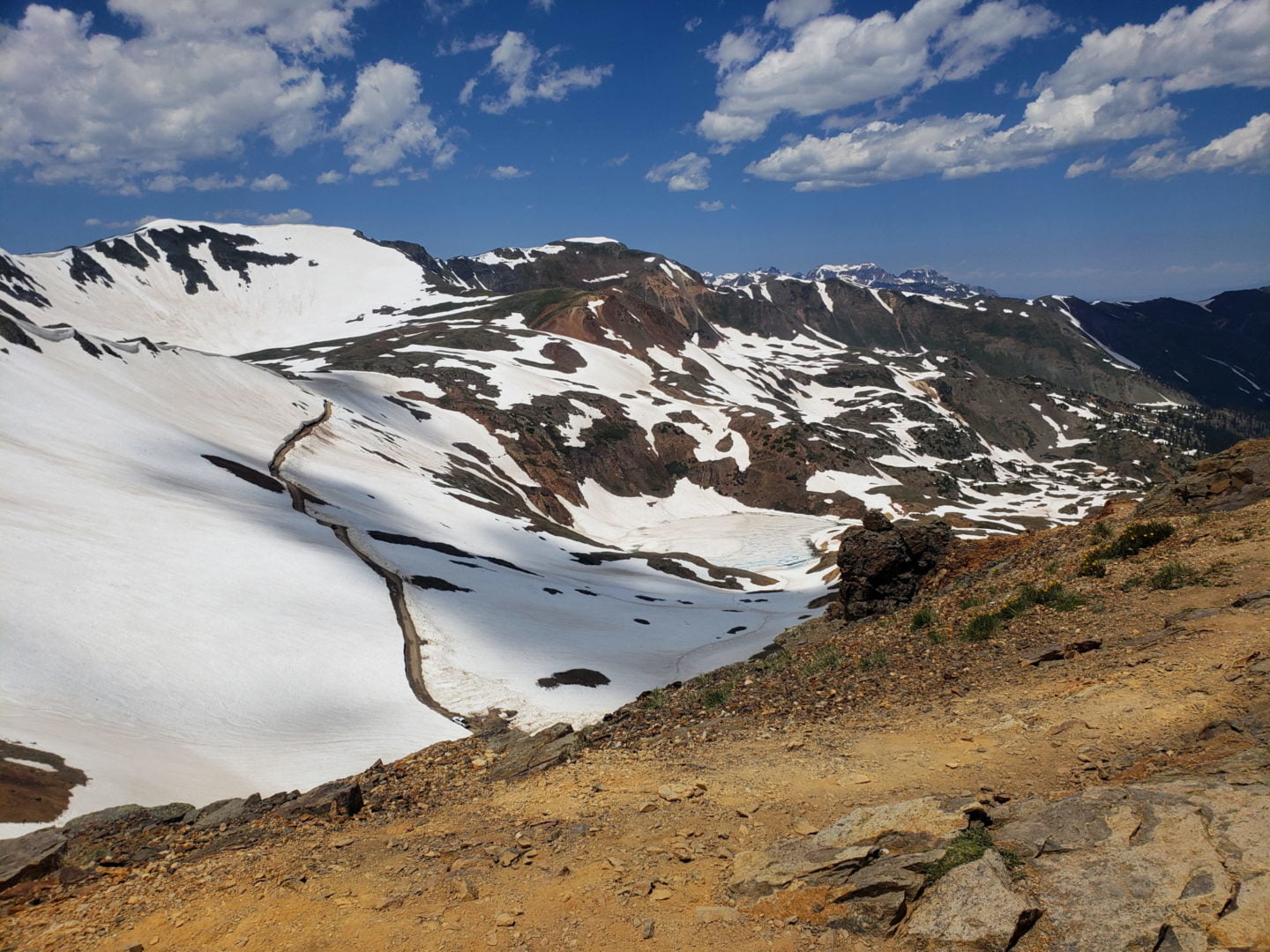
View of Como Lake, near California Pass
View of Como Lake, near California Pass
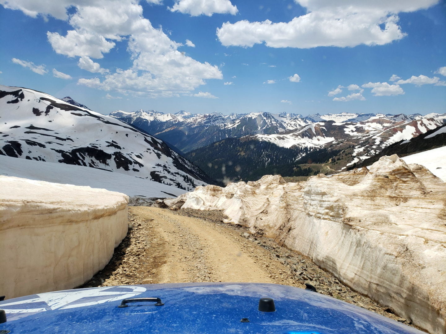
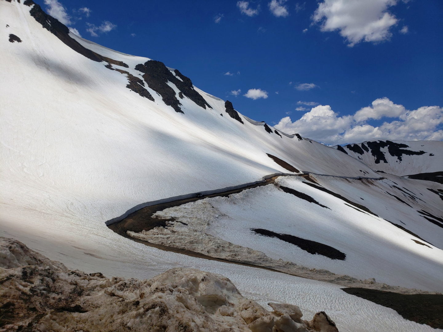
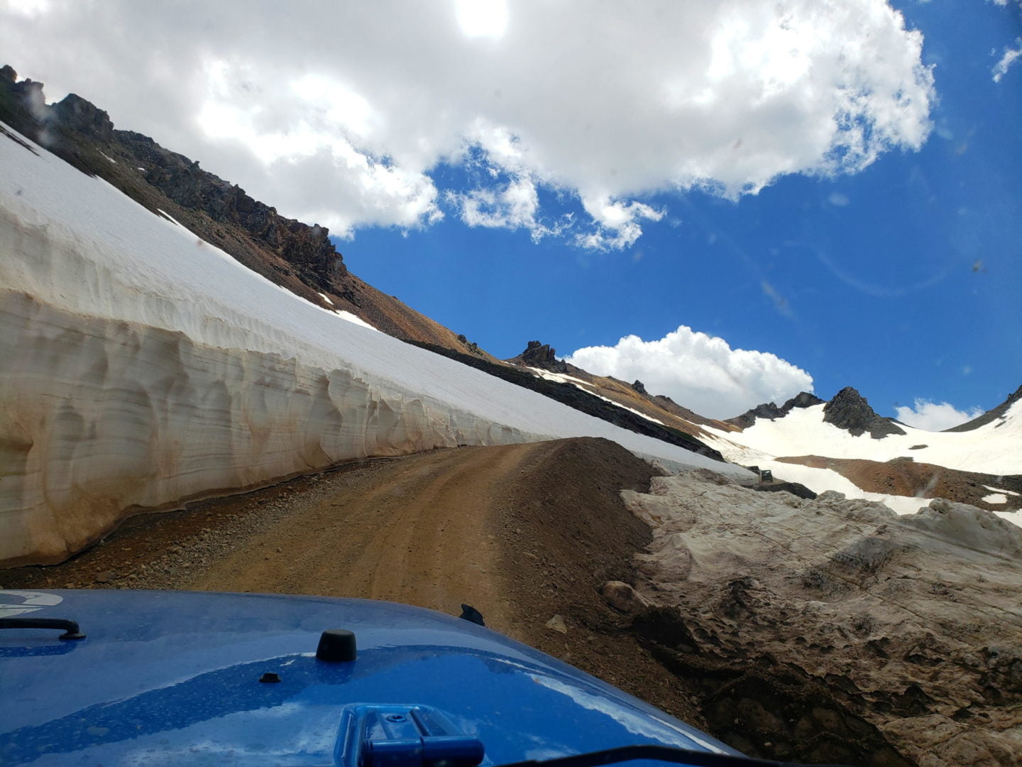
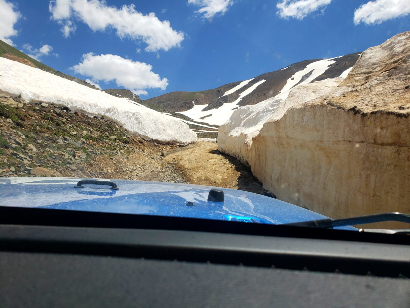
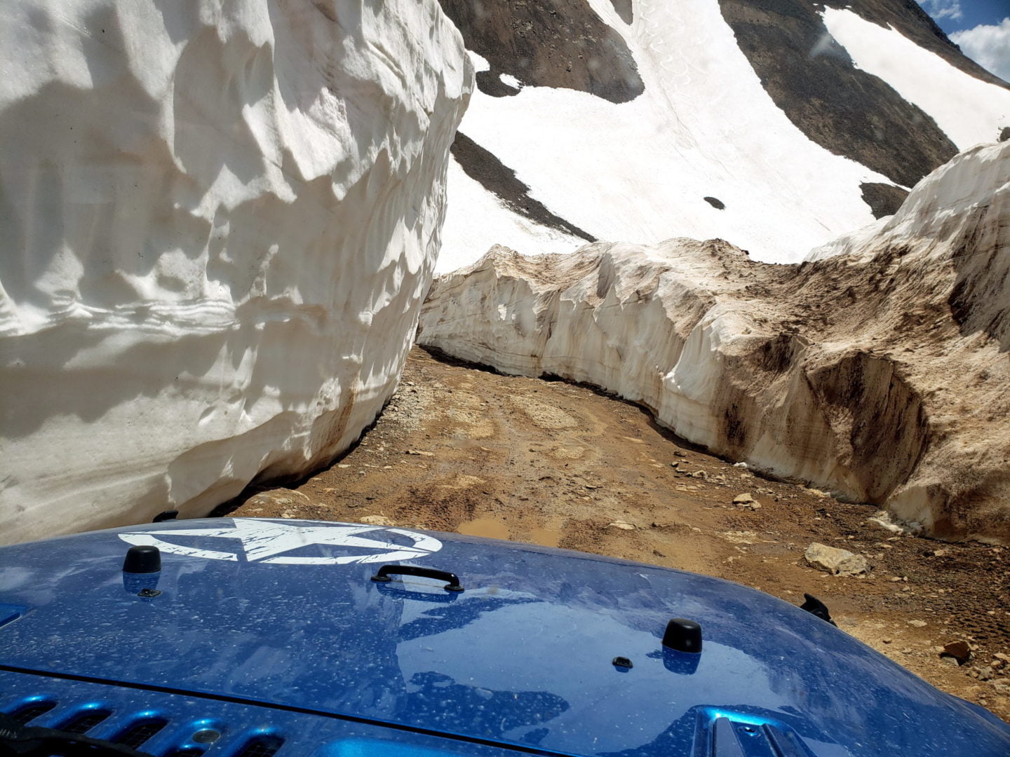
15′-20′ walls of snow through snow drifts
15′-20′ walls of snow through snow drifts
It’s amazing that CR10 is open given the amount of snow
It’s amazing that CR10 is open given the amount of snow
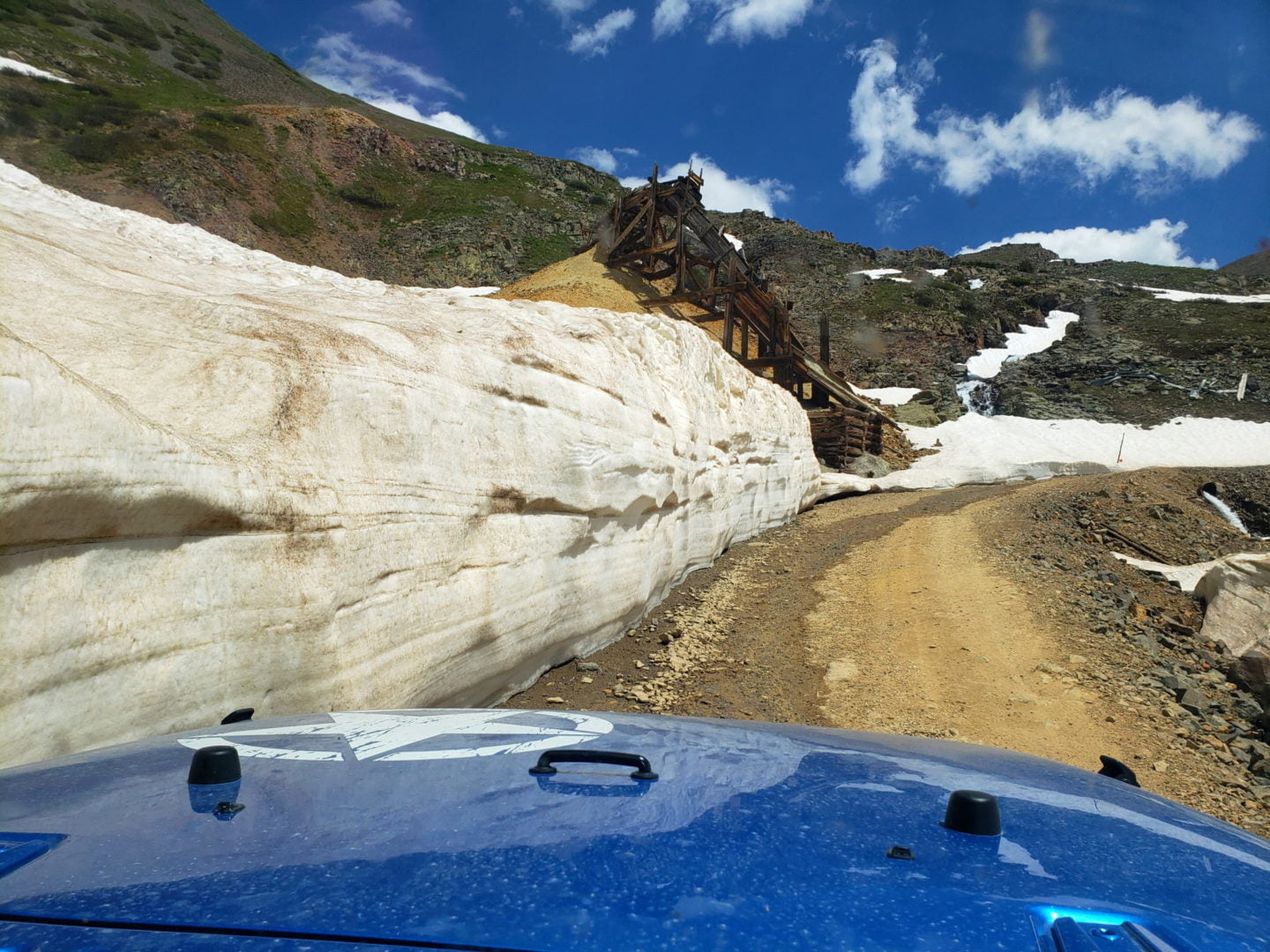
Snowdrift Mine ore chute
Snowdrift Mine ore chute
Reaching deep snow drifts along CR10
Reaching deep snow drifts along CR10
Reaching treeline on CR10
Reaching treeline on CR10
Looking back at SH110 towards Silverton
Looking back at SH110 towards Silverton
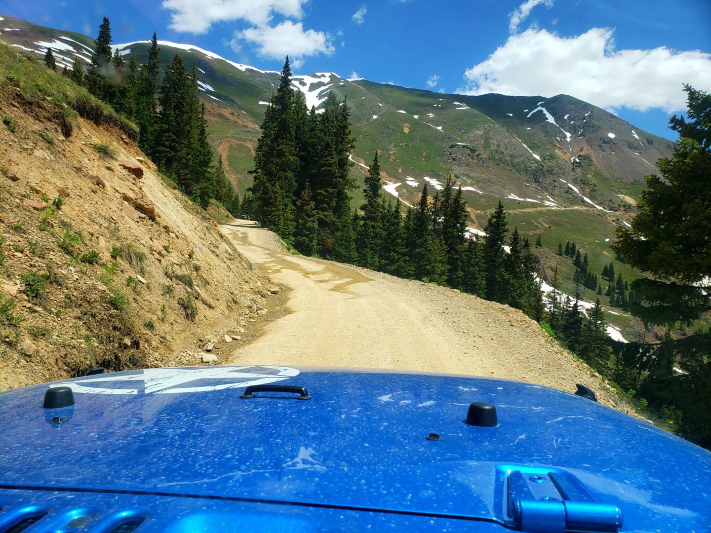
CR10 starts out in great shape
CR10 starts out in great shape
View from SH110 above Silverton
View from SH110 above Silverton
Towering walls of snow on the way down
Towering walls of snow on the way down
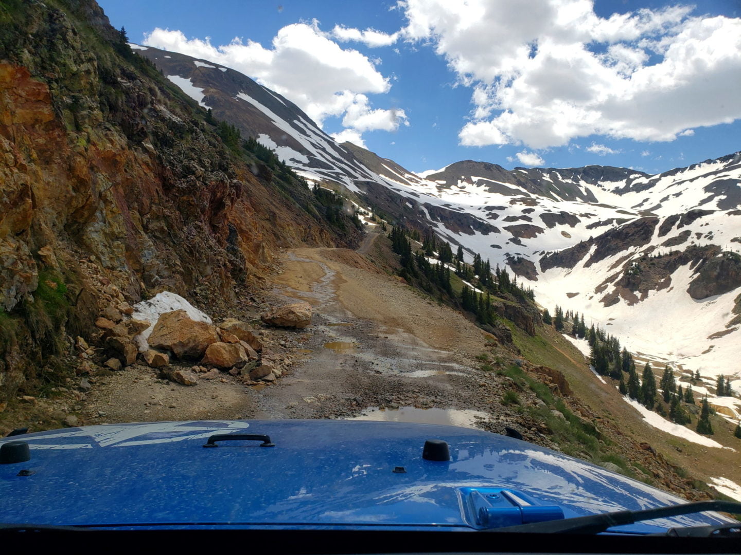
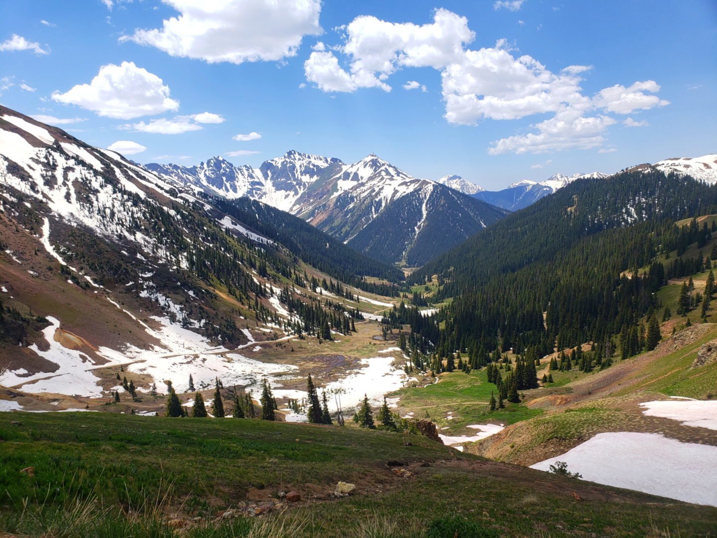
View of California Gulch
View of California Gulch

Incredible views from the passes
Incredible views from the passes
GPS Route with Elevation
Video Tour
Weather
Route Directions
Starting from Silverton, exit Highway 550 onto Greene St./Hwy 110
Continue on Hwy 110 through Silverton (1.2 Miles)
Turn left to stay on Hwy 110 (6.4 Miles)
Slight left onto County Rd 10/Hurricane Pass
Trailhead Directions