Lake Isabelle (10,910′), Front Range
Lake Isabelle lies hidden in a high, isolated bowl-shaped basin at the top of the South St. Vrain drainage in the Brainard Lake Recreation Area. It lies at tree-line in a stunning alpine valley surrounded by Navajo (13,409′), Apache (13,441′) and Shoshoni (12,967′) peaks. The Continental Divide is located just west of the lake, running along the high peaks above the valley.
Mitchell & Blue Lake and Mt Audubon, are also located in the Brainard Lake Recreation Area and also offer beautiful views of the Indian Peaks Wilderness.
Trail Stats
- Trailhead: Long Lake
- Round trip: 4.4 miles/7.1 km summer, 11 miles/17.1 km winter
- Elevation: 10,300′ – 10,910′ / 3,139 m – 3,325 m
- County: Boulder – Brainard Lake Rec. Area
- National Forest: Roosevelt
- Wilderness: Indian Peaks

Trail Pictures

Park closed in winter to motorized vehicles
Park closed in winter to motorized vehicles

Brainard Lake Rec. Area
Brainard Lake Rec. Area

Road to the Long Lake trailhead
Road to the Long Lake trailhead

Out of control bike ride along the closed road
Out of control bike ride along the closed road
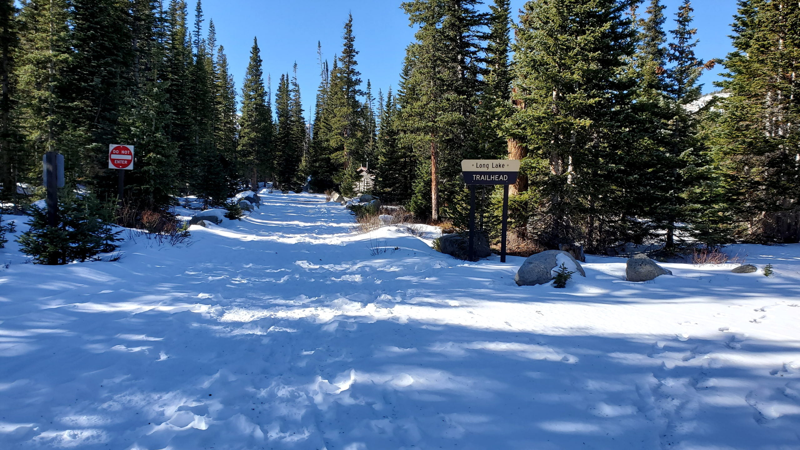
Long Lake Trailhead
Long Lake Trailhead

View through the dense forest
View through the dense forest
Long Lake, Brainard Lake Rec Area
Long Lake, Brainard Lake Rec Area

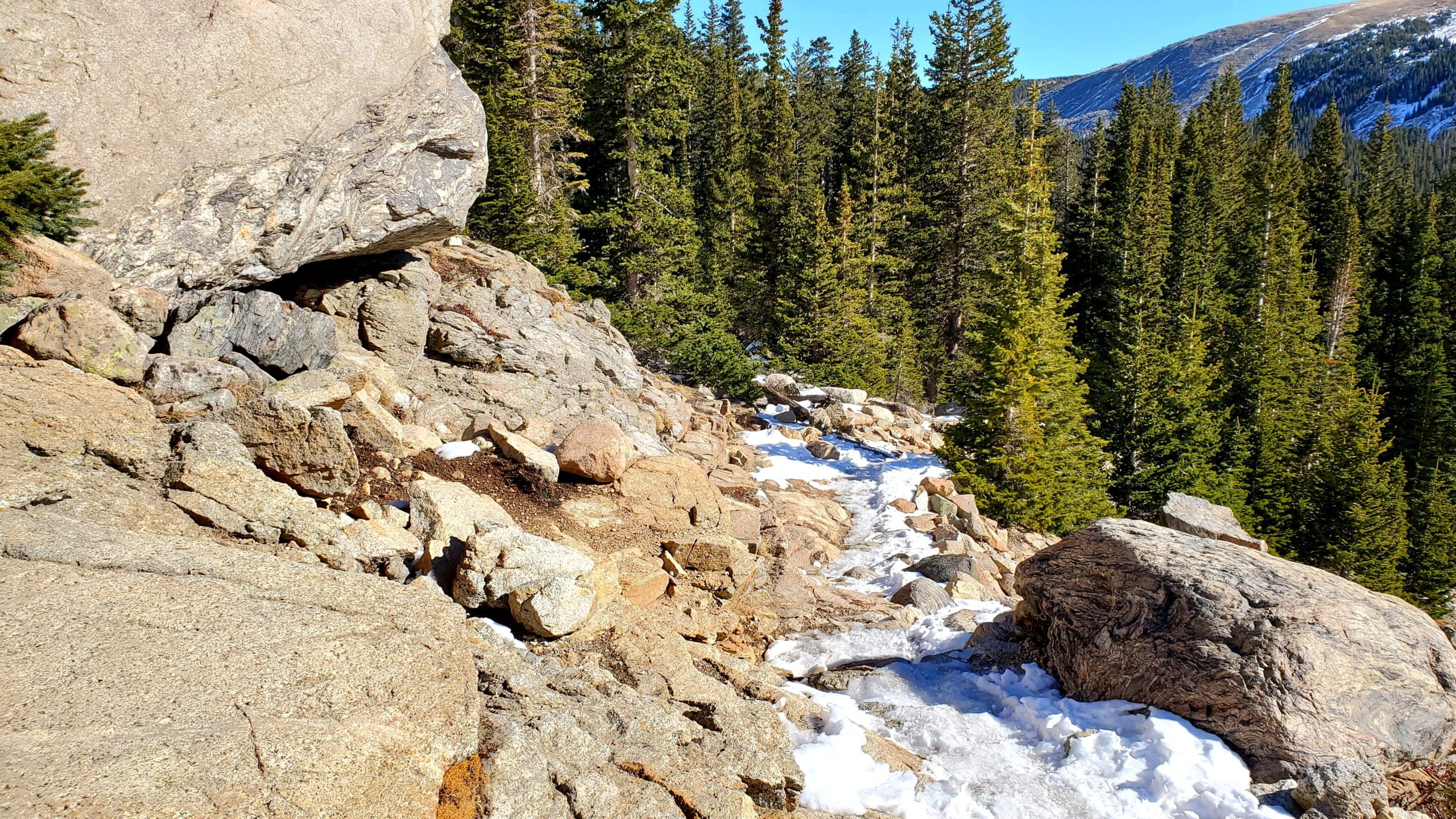
Trail in great winter condition
Trail in great winter condition

Long Lake, with sounds of moose nearby
Long Lake, with sounds of moose nearby

One of the many creek crossings
One of the many creek crossings

Shoshoni Peak ahead
Shoshoni Peak ahead

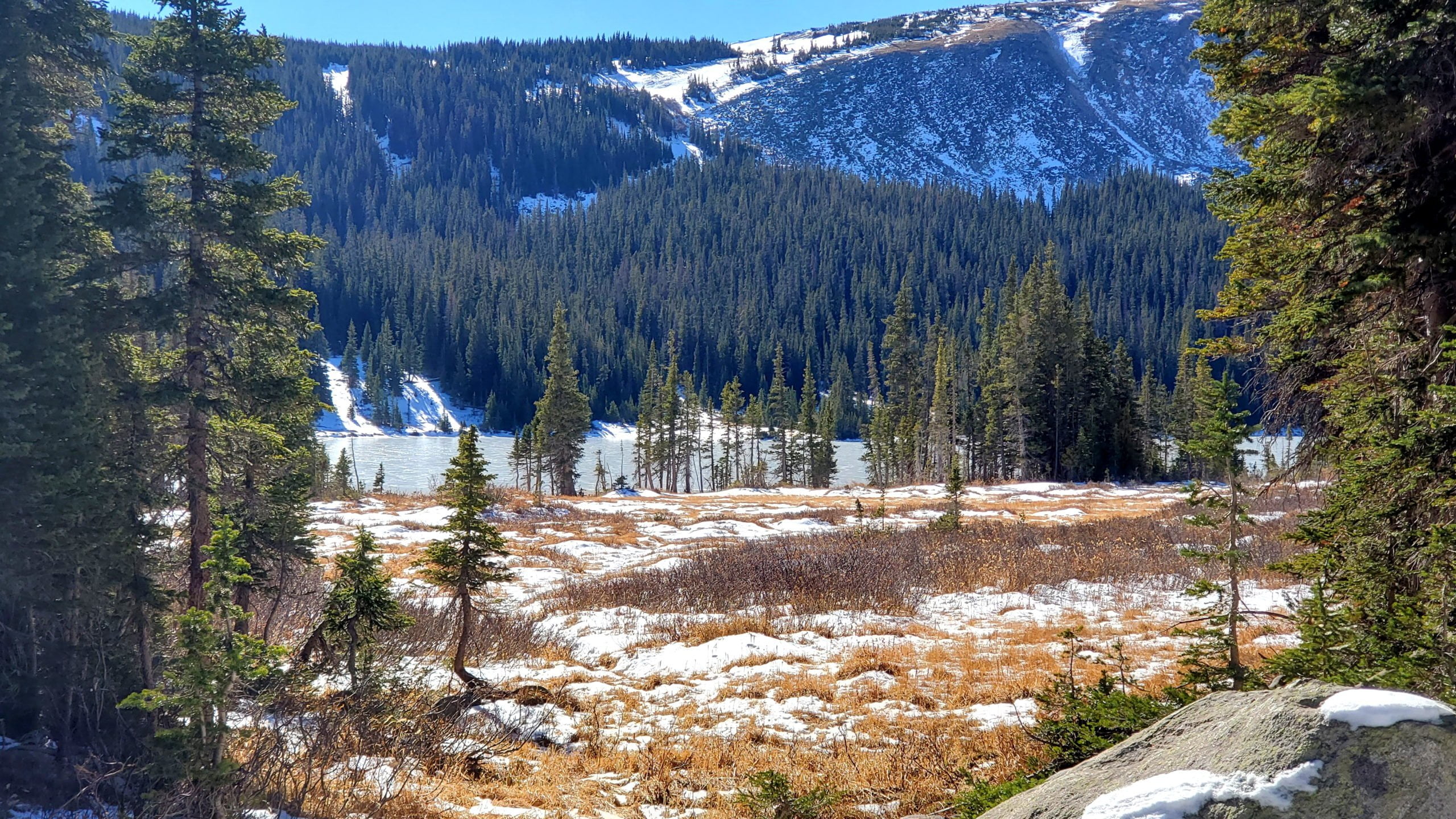
Meadow on the way to Lake Isabelle
Meadow on the way to Lake Isabelle

As you near Lake Isabelle the trees thin out
As you near Lake Isabelle the trees thin out

The upper portion of the South St. Vrain Creek valley
The upper portion of the South St. Vrain Creek valley
Above Lake Isabelle
Above Lake Isabelle

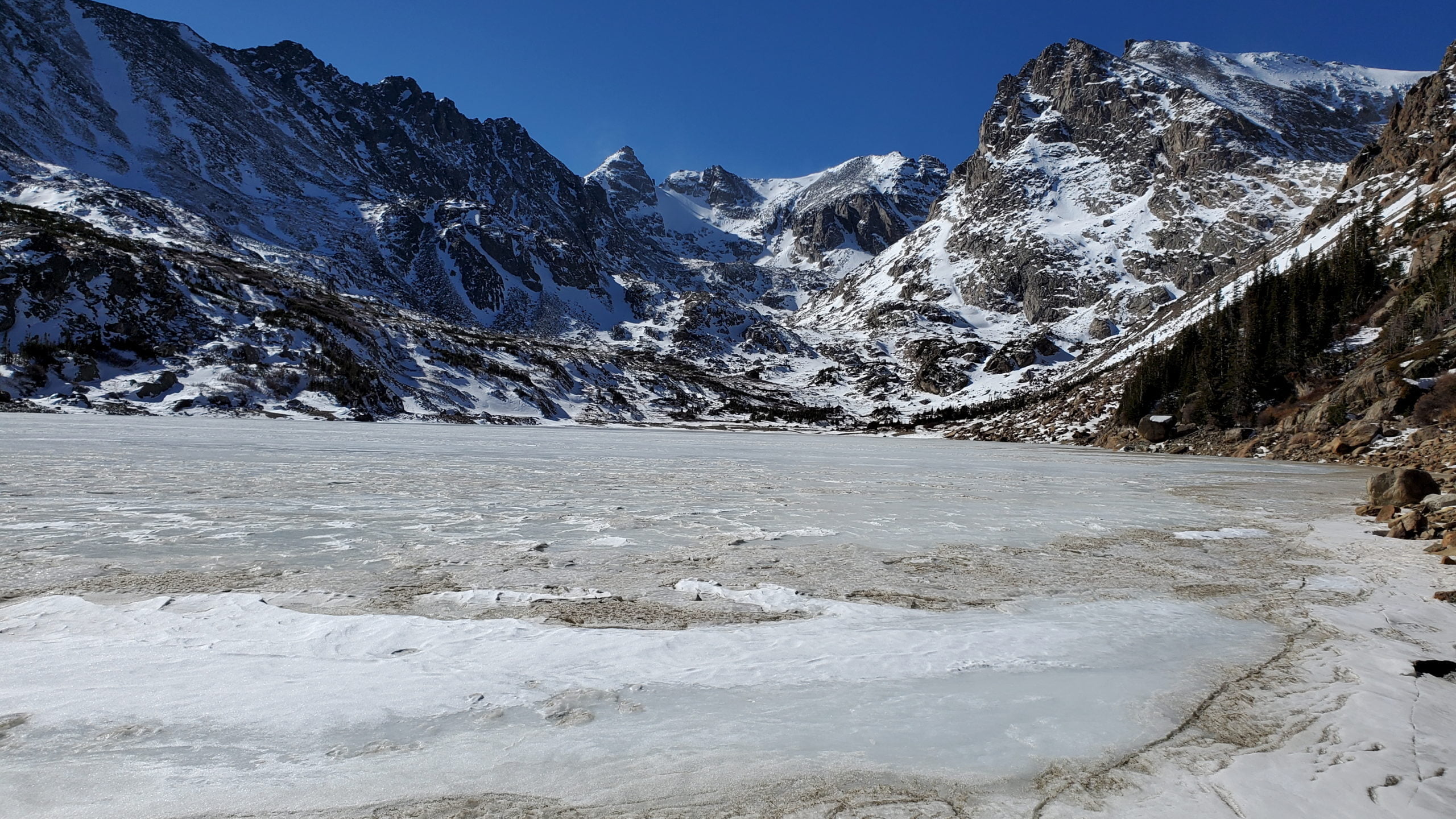
The incredible scenery of Lake Isabelle
The incredible scenery of Lake Isabelle

Panorama of Lake Isabelle
Panorama of Lake Isabelle

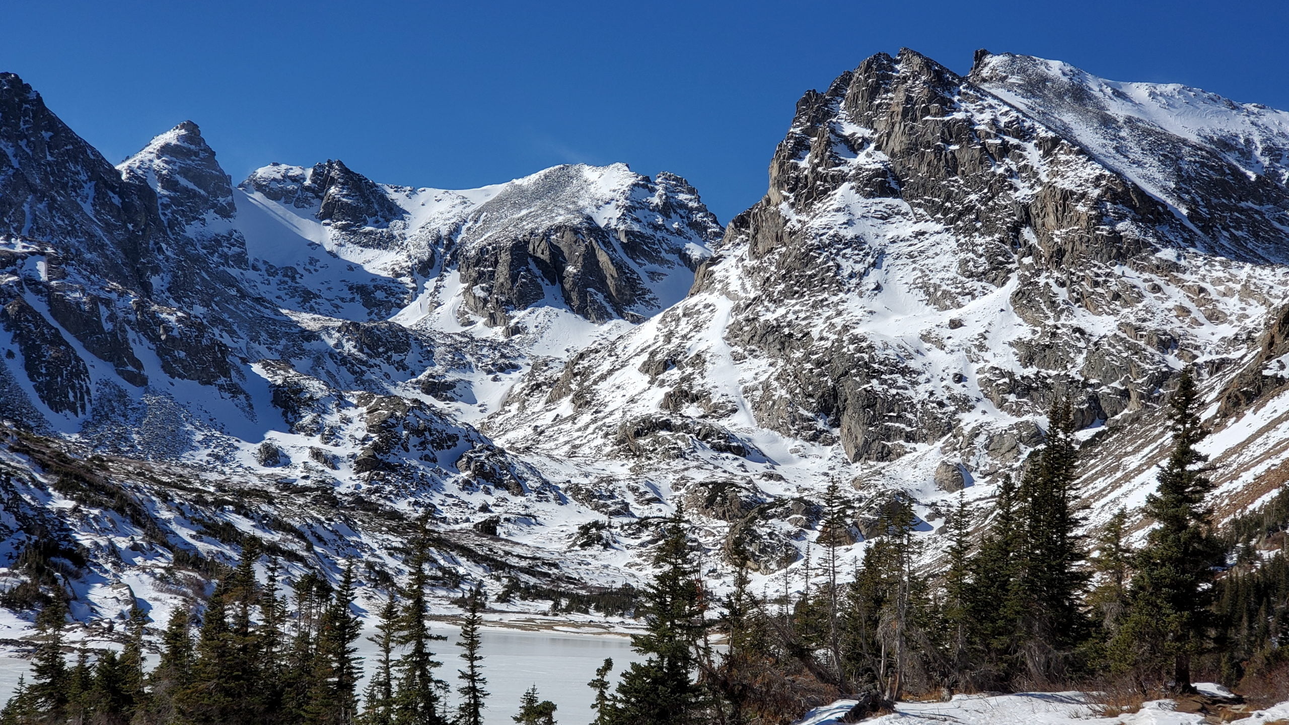
Niwot Ridge, 13,409-foot Navajo Peak, Navajo Glacier, 13,441-foot Apache Peak and 12,967-foot Shoshoni Peak, looking from left to right
Niwot Ridge, 13,409-foot Navajo Peak, Navajo Glacier, 13,441-foot Apache Peak and 12,967-foot Shoshoni Peak, looking from left to right

The Continental Divide lies along the jagged peaks
The Continental Divide lies along the jagged peaks

View along the northern shore
View along the northern shore
View from the waters edge
View from the waters edge

One last look at Lake Isabelle
One last look at Lake Isabelle

Winter in full display in early November
Winter in full display in early November
Heading back to the Long Lake trailhead
Heading back to the Long Lake trailhead
GPS Route with Elevation
Video Tour
Trail Directions
From the Long Lake Trailhead, the trail begins its relatively gentle ascent up to Long Lake. After a quarter-mile of trekking, the trail intersects the Jean Lunning Trail, which will take you to and around Long Lake. This area is known for moose sightings. Avoid the Jean Lunning Trail and continue to the right uphill to Lake Isabelle.
After approximately 1 more mile, the trail intersects the Jean Lunning Trail for the second time. Again, continue towards Lake Isabelle and Pawnee Pass, bypassing the Jean Lunning Trail. Lake Isabelle is just another .9 miles beyond this trail junction. From the lake you have the option of continuing further up the trail to reach Isabelle Glacier.
Trailhead Directions