Music Pass (11,450′), Sangre de Cristo Range
Music Pass is a east/west pass across the southern Sangre de Cristo range connecting the Wet Valley in the east with the Great Sand Dunes National Park and Preserve on the western side. The road gets progressively worse as you near the trailhead, so without a high clearance 4-wheel drive vehicle, you should park at the Grape Creek Trailhead and hike the last 2.5 miles to the Music Pass trailhead. The trail stats assume that you are beginning your hike at the Music Pass Trailhead.
Reaching the pass, you have a stunning views of the Upper Sand Creek basin that includes 13ers Marble Mountain, Milwaukee Peak, Music Mountain, and Tijeras Peak.
The Sangre de Cristo range has a wide range of remote and rugged hikes, such as Lily Lake, South Colony Lakes, and Humboldt Peak .
Trail Stats
- Trailhead: Music Pass
- Round trip: 3 miles / 4.8 km
- Elevation: 10,730′ – 11,450′ / 3490 m
- County: Huerfano
- Wilderness: Sangre de Cristo
- National Park: Great Sand Dunes National Park and Preserve

Trail Pictures

The road becomes more difficult after the Grape Creek TH
The road becomes more difficult after the Grape Creek TH

Near the trailhead
Near the trailhead

The trail used to be open to vehicles decades ago
The trail used to be open to vehicles decades ago

First mile of the trail is in dense forest
First mile of the trail is in dense forest

The trail alternates between steep and level areas
The trail alternates between steep and level areas

Upper Sand Creek basin
Upper Sand Creek basin

Easy to follow trail from the trailhead
Easy to follow trail from the trailhead

Inviting meadows about a mile into the hike
Inviting meadows about a mile into the hike

Once on the pass head north up a small hill for incredible views.
Once on the pass head north up a small hill for incredible views.

Wildflowers in full bloom
Wildflowers in full bloom
Reaching Music Pass from the east
Reaching Music Pass from the east

Marble Mountain (13,266′) to the north of Music Pass
Marble Mountain (13,266′) to the north of Music Pass

View of Music Pass from the north
View of Music Pass from the north
Music Pass (11,450′)
Music Pass (11,450′)

View south towards Blueberry Peak
View south towards Blueberry Peak

Every year it becomes more difficult to plan hikes around the smoke from fires to the west
Every year it becomes more difficult to plan hikes around the smoke from fires to the west

View of the western side of the valley
View of the western side of the valley

Looking north from the pass
Looking north from the pass

View northeasterly from the pass
View northeasterly from the pass

View to the east of the Wet Valley shrouded in smoke
View to the east of the Wet Valley shrouded in smoke

Views to the west of 13rs Milwaukee Mountain and Music Peak
Views to the west of 13rs Milwaukee Mountain and Music Peak

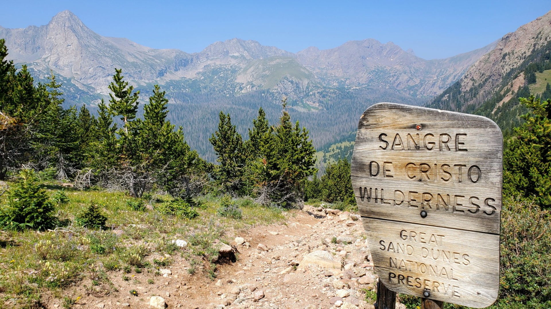
Music Pass and the Sangre de Cristo wilderness boundary
Music Pass and the Sangre de Cristo wilderness boundary
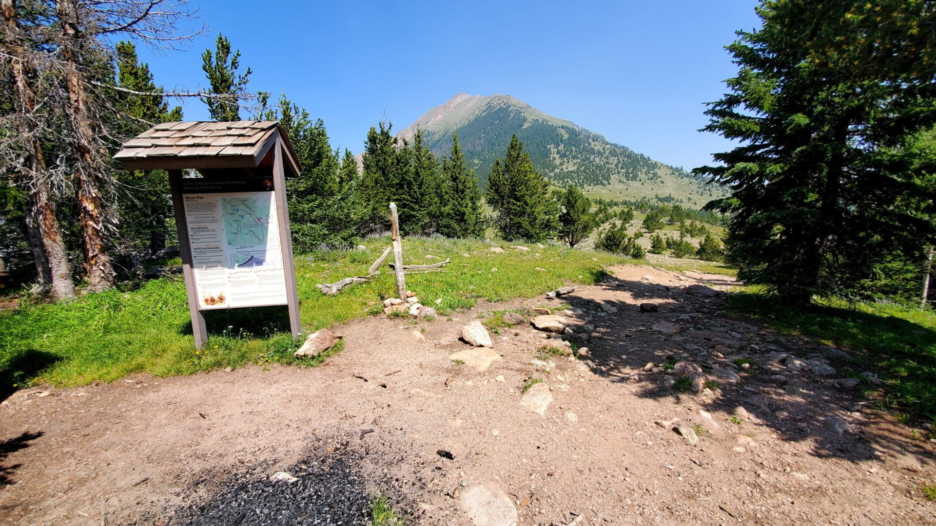
Entering the Great Sand Dunes National Preserve
Entering the Great Sand Dunes National Preserve

An abundance of mushrooms along the trail.
An abundance of mushrooms along the trail.

Nearing Music Pass from the east
Nearing Music Pass from the east

CR 119 leaving Music Pass Rd
CR 119 leaving Music Pass Rd
GPS Route with Elevation
Video Tour
Trail Directions
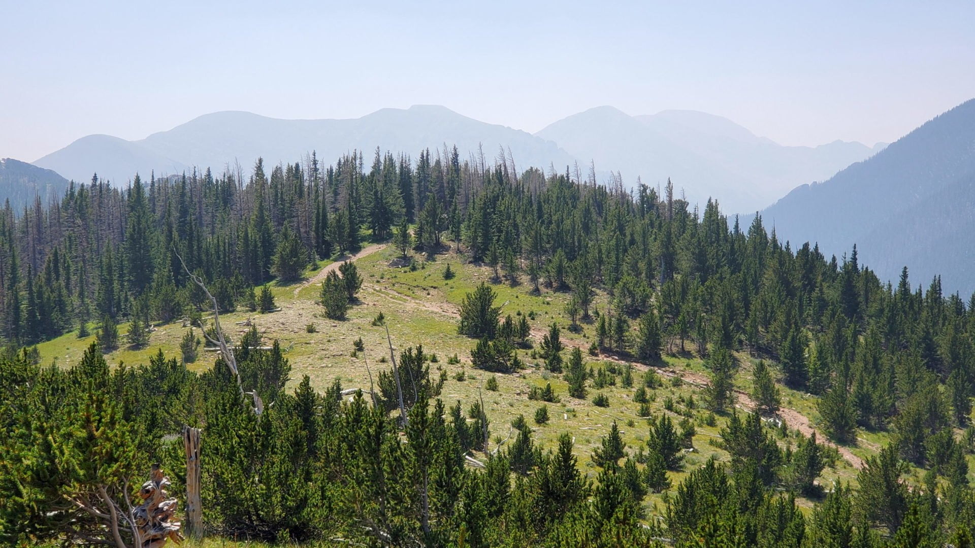
From the parking area at the end of Music Pass Road the trail immediately enters a dense conifer forest as it begins climbing toward the pass. Initially you won’t see much but trees, but after about a mile the forest starts to become more open, giving you some great views of the Wet Mountain Valley on the east side of the Sangre de Cristo Range.
Finally, just before reaching the pass you will pass a sign indicating that you are entering the Great Sand Dunes National Preserve, an extension of the Great Sand Dunes National Park on the western side of the range. This point also marks the eastern boundary of the Sangre de Cristo Wilderness Area.
Trailhead Directions