Tincup Pass (12,154′), Sawatch Range
Tincup Pass gets its name from prospector Jim Taylor, who in 1860 brought his gold strike back to camp in his tin cup. The pass was used to move supplies between St. Elmo and the town of Tin Cup starting in 1881, when a wagon road was built.
The views and hiking opportunities along the road are abundant. There are 13,000′ peaks that can be easily accessed from 267 (Tin Cup Peak, PT 13,050, and Fitzpatrick Peak). In addition, the prominent Continental Divide Trail and Colorado Trail cross Tin Cup Pass Rd (267) about 4 miles from St. Elmo.
The Sawatch Mountain Range is home to fifteen 14,000′ peaks, such as Huron Peak, La Plata Peak, Missouri Mountain, Mt Antero, and the highest peak in the Rocky Mountains, Mt Elbert.
Trail Stats
- Road: 267
- Round trip: 24 miles / 38.6 km (St Elmo to Tin Cup and back)
- Elevation: 9,961′ – 12,154′ / 3,036 m – 3,705 m
- County: Gunnison
- Agency: U.S. Forest Service
- Nat’l Forest: San Isabel & Gunnison

Trail Pictures

Paved Highway over Cottonwood Pass 12,126′
Paved Highway over Cottonwood Pass 12,126′
Leaving Tin Cup on the way to Cottonwood Pass
Leaving Tin Cup on the way to Cottonwood Pass
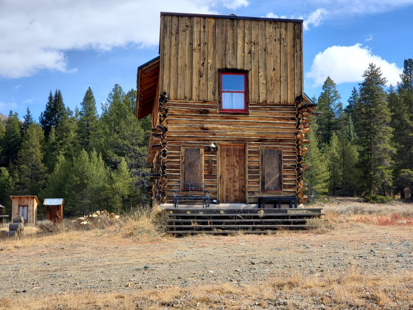
Many historic buildings in the town of Tin Cup
Many historic buildings in the town of Tin Cup
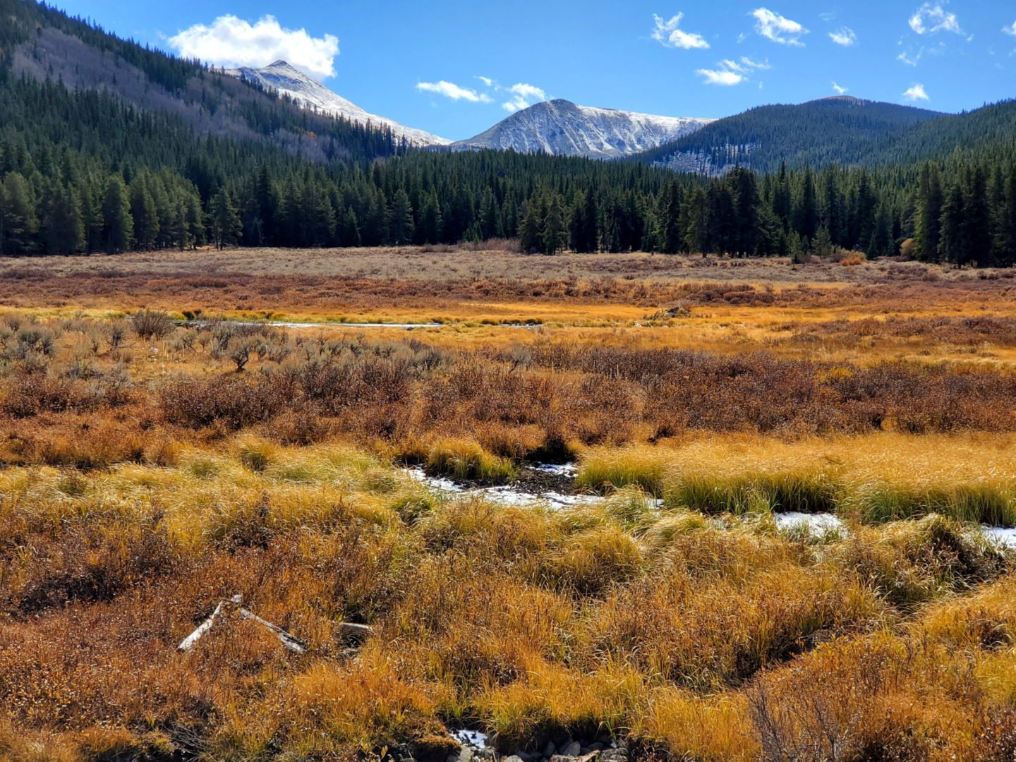
Beautiful fall colors in the meadows
Beautiful fall colors in the meadows

View near the Tin Cup cemetery
View near the Tin Cup cemetery
Historic buildings are used as summer homes
Historic buildings are used as summer homes

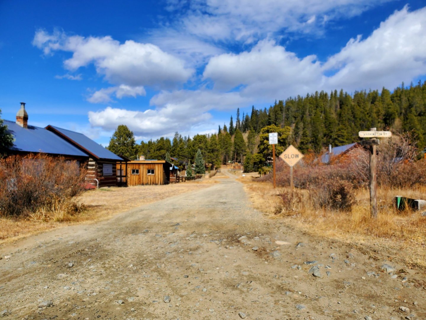
The town of Tin Cup
The town of Tin Cup
West of Mirror Lake the road conditions improve
West of Mirror Lake the road conditions improve
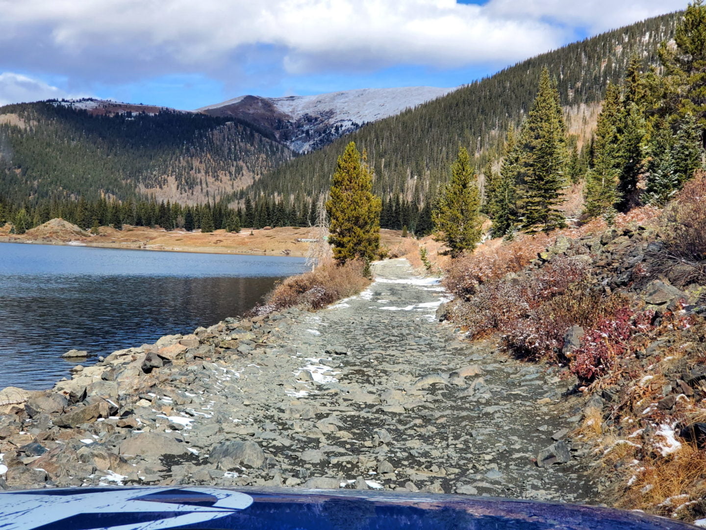
The road consists of large talus along Mirror Lake
The road consists of large talus along Mirror Lake
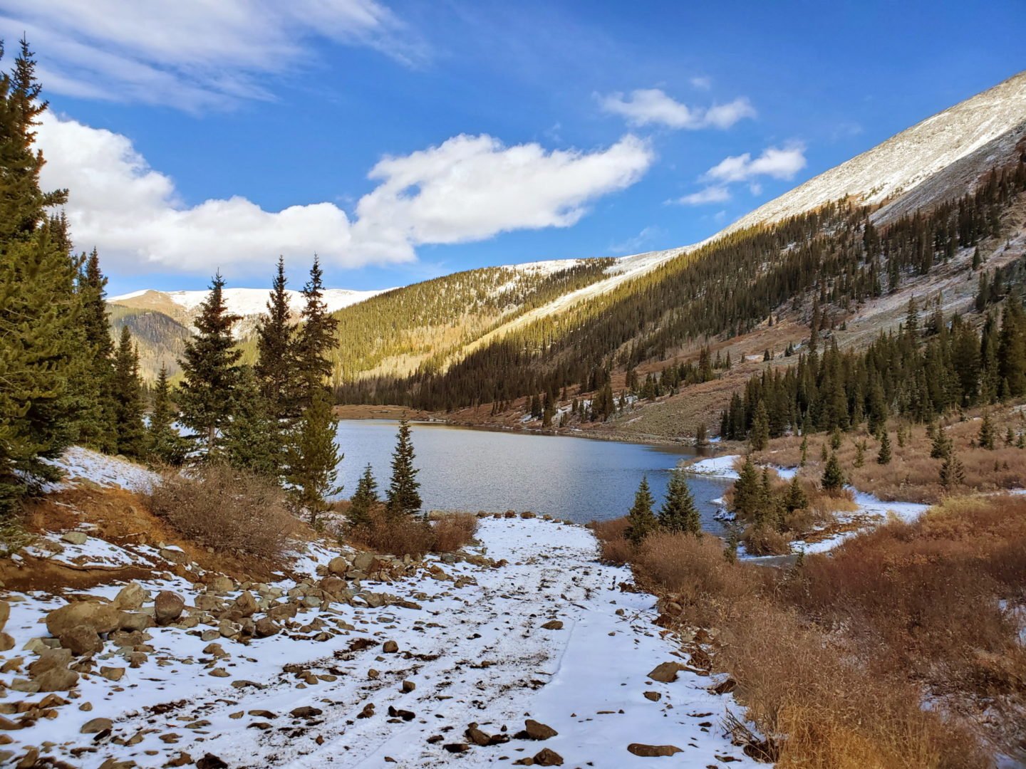
Mirror Lake lies on the north side of the pass
Mirror Lake lies on the north side of the pass
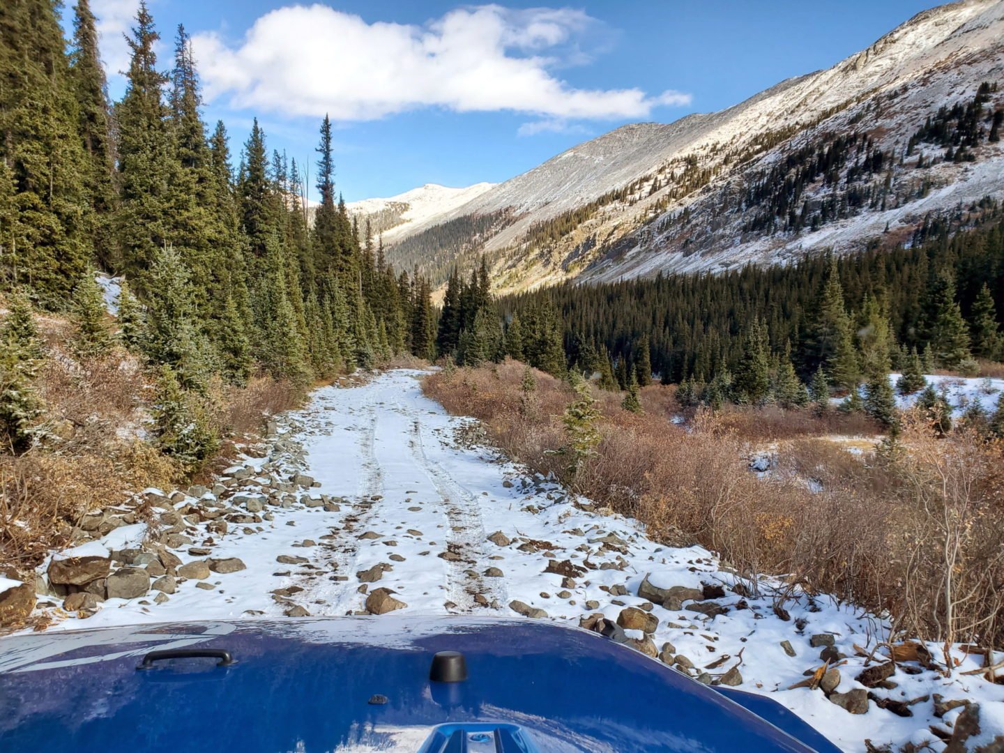
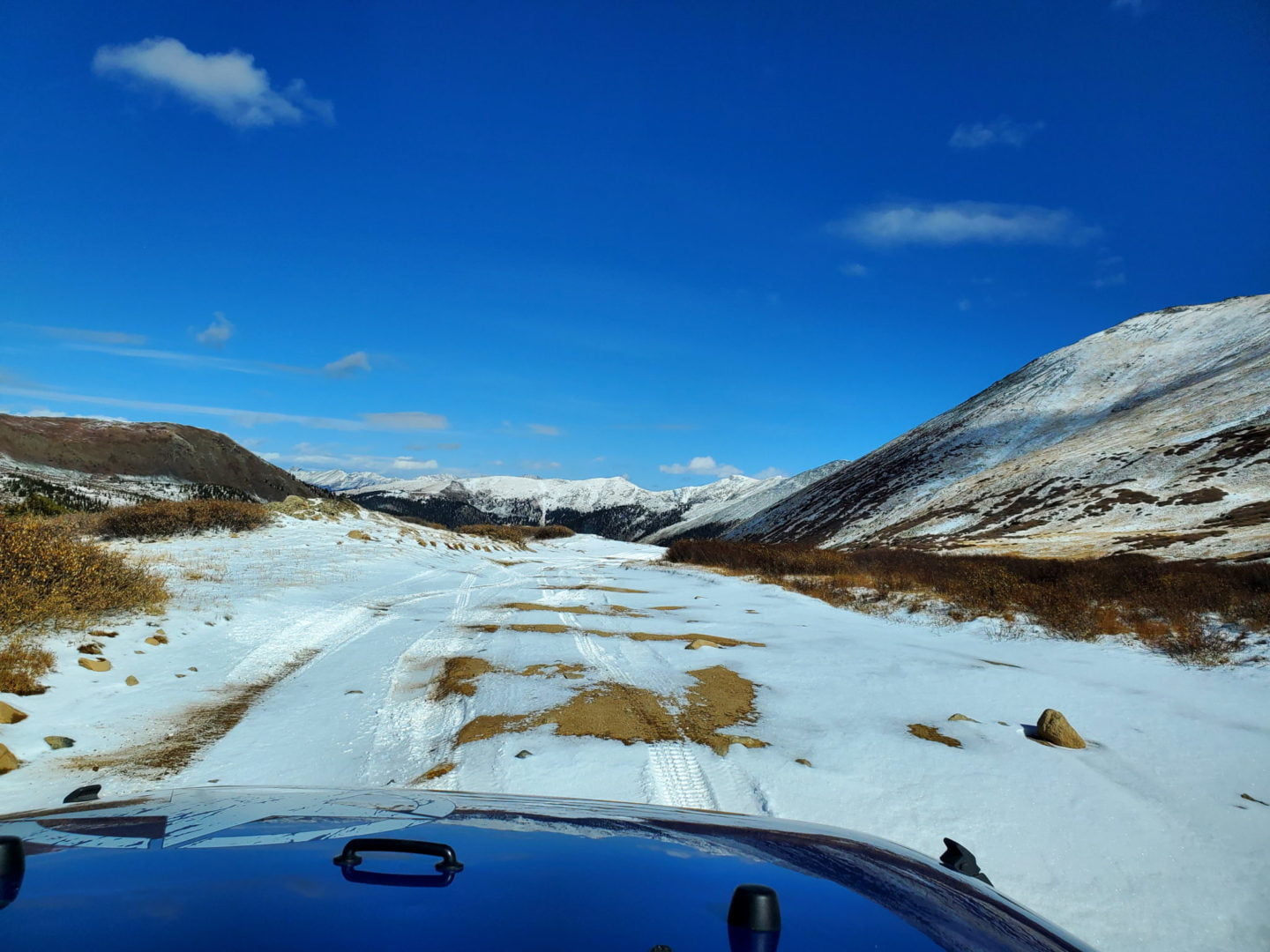
The road cleared up quickly and became wider
The road cleared up quickly and became wider
View of the north side of Tincup Pass
View of the north side of Tincup Pass
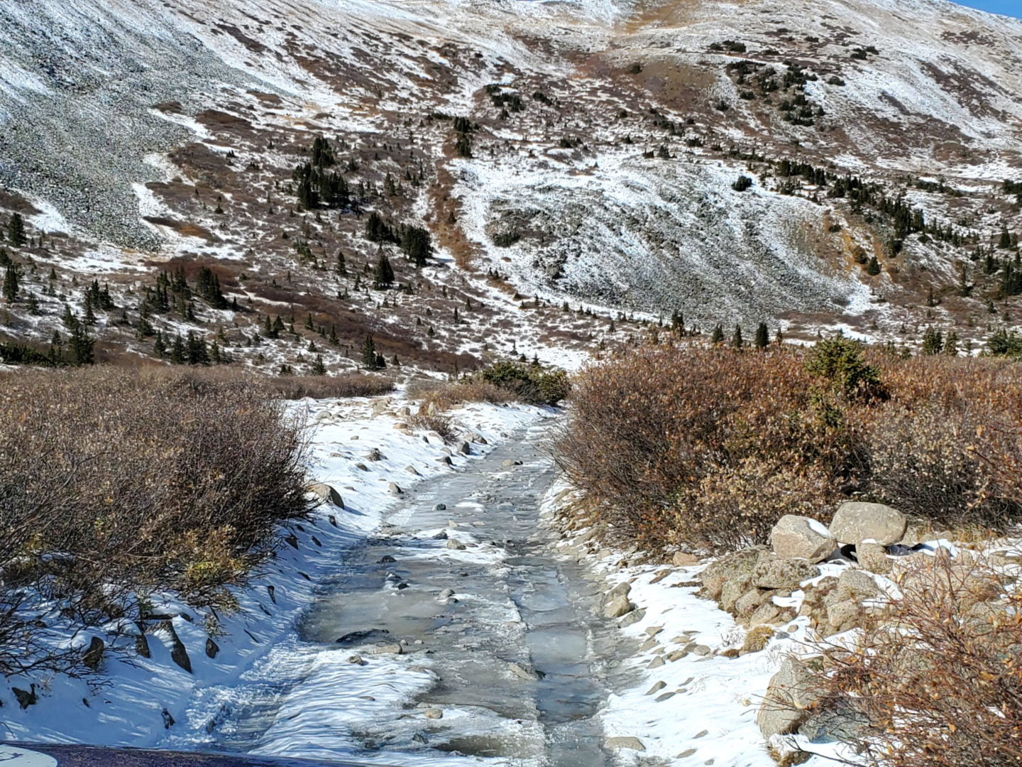
Creeping down the steep section as the ice got worse
Creeping down the steep section as the ice got worse

Ice becomes an issue coming down the north side of Tincup Pass
Ice becomes an issue coming down the north side of Tincup Pass
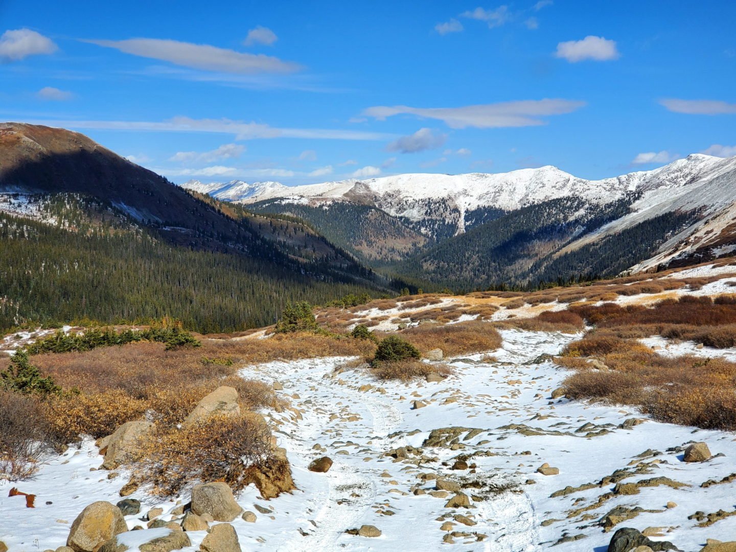
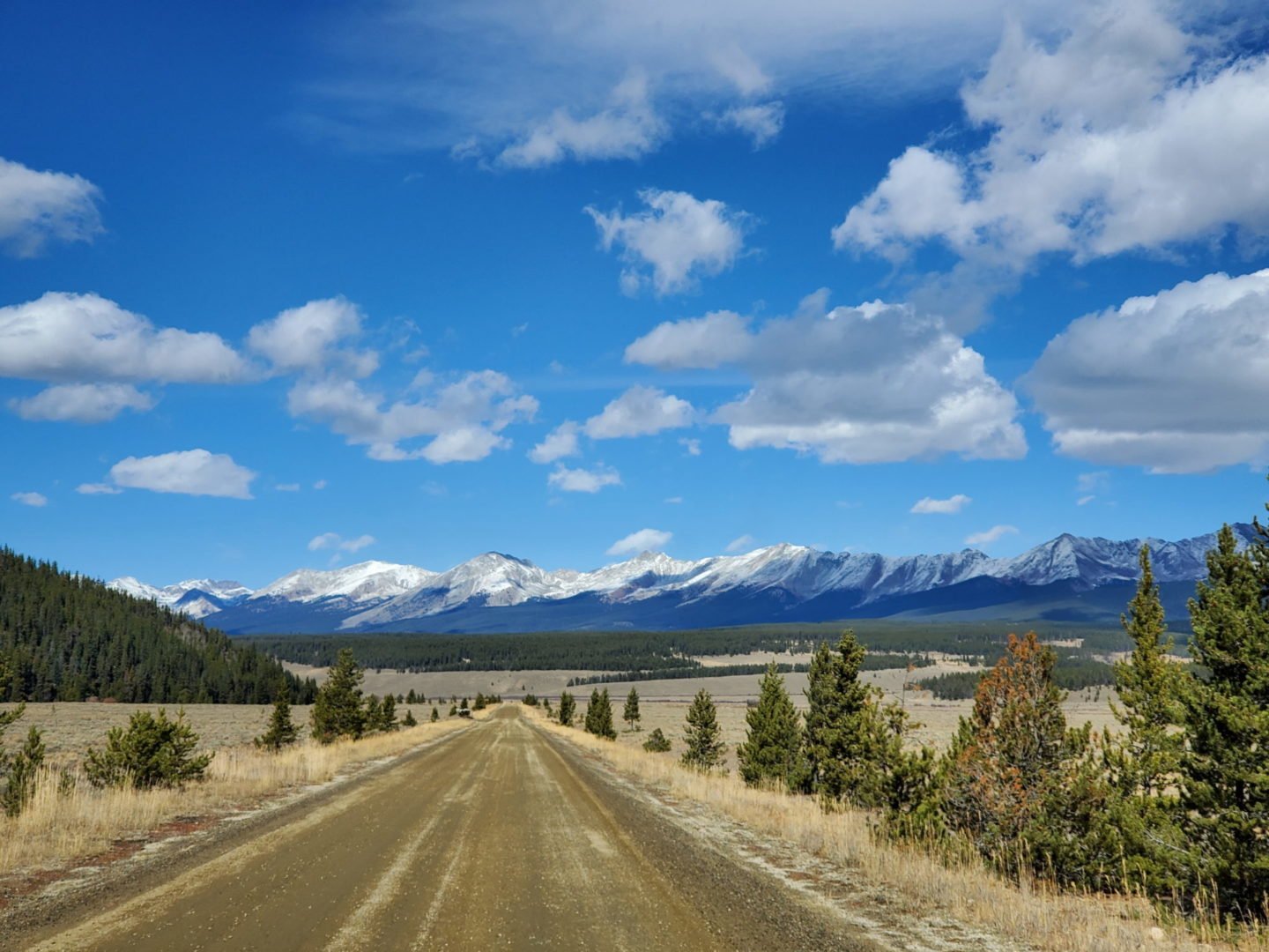
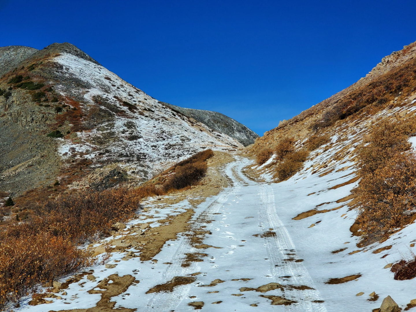
The road winding north through the tundra
The road winding north through the tundra

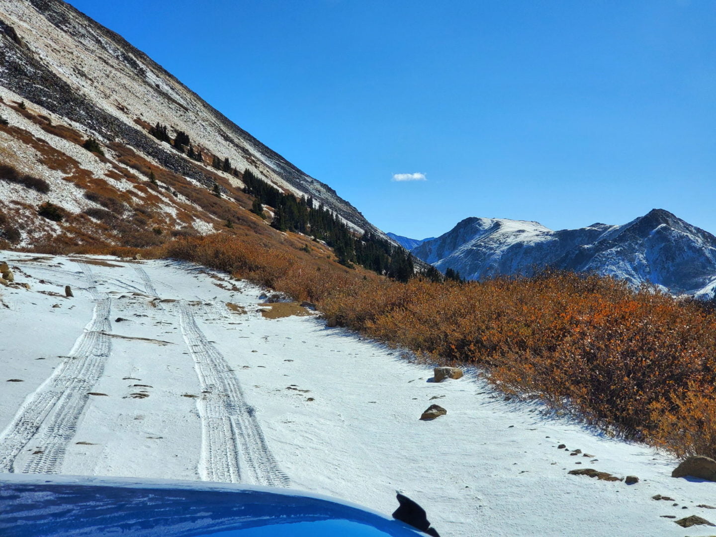
Looking into the East Willow Creek drainage
Looking into the East Willow Creek drainage
View north from Tincup Pass
View north from Tincup Pass
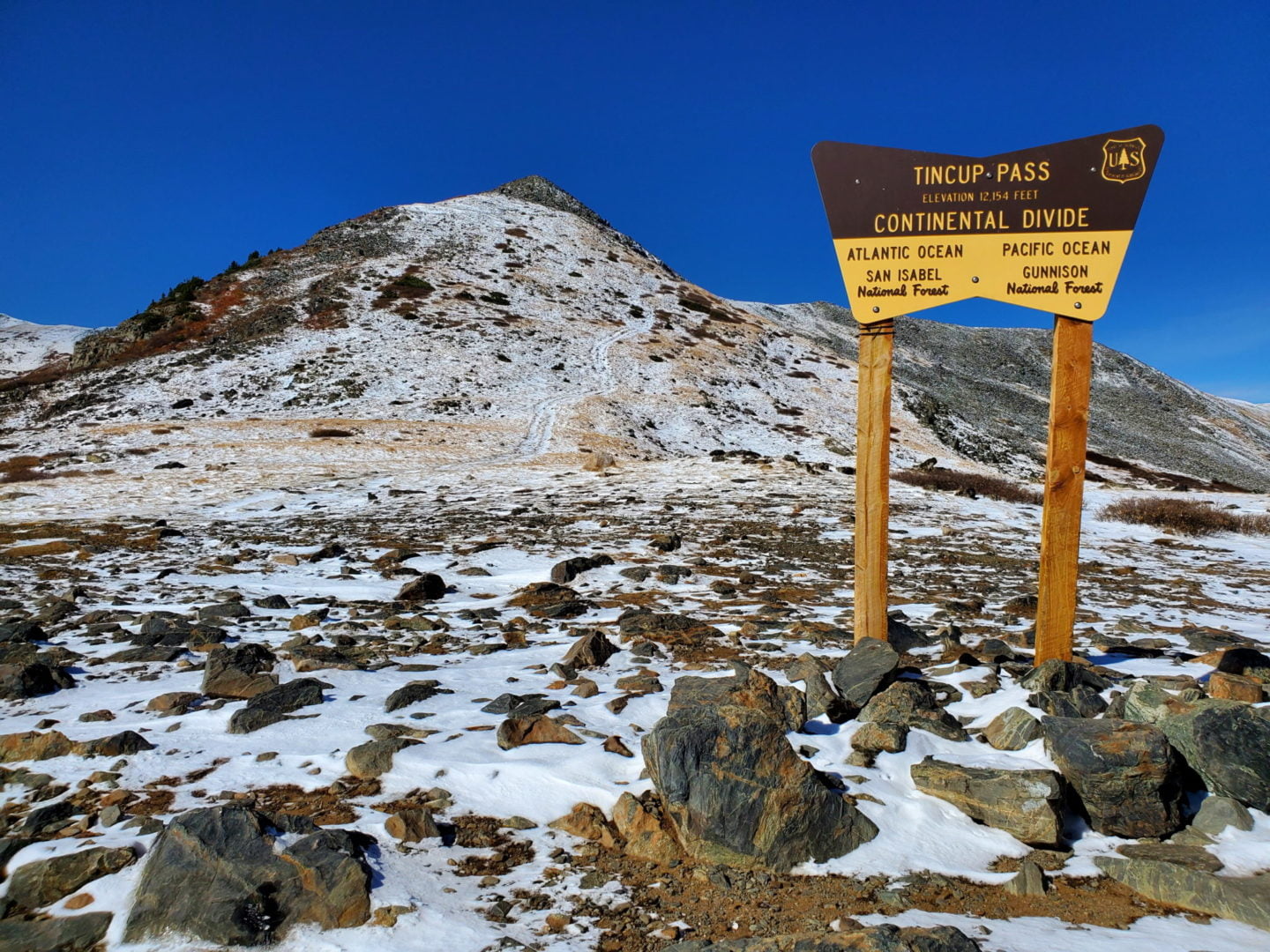
Tincup Pass 12,154′ – part of the Continental Divide Trail (CDT)
Tincup Pass 12,154′ – part of the Continental Divide Trail (CDT)
Nearing the summit
Nearing the summit
A light dusting of snow
A light dusting of snow
The shelf road near treeline
The shelf road near treeline

Rough road approaching treeline
Rough road approaching treeline

Avalanche debris from last winter
Avalanche debris from last winter
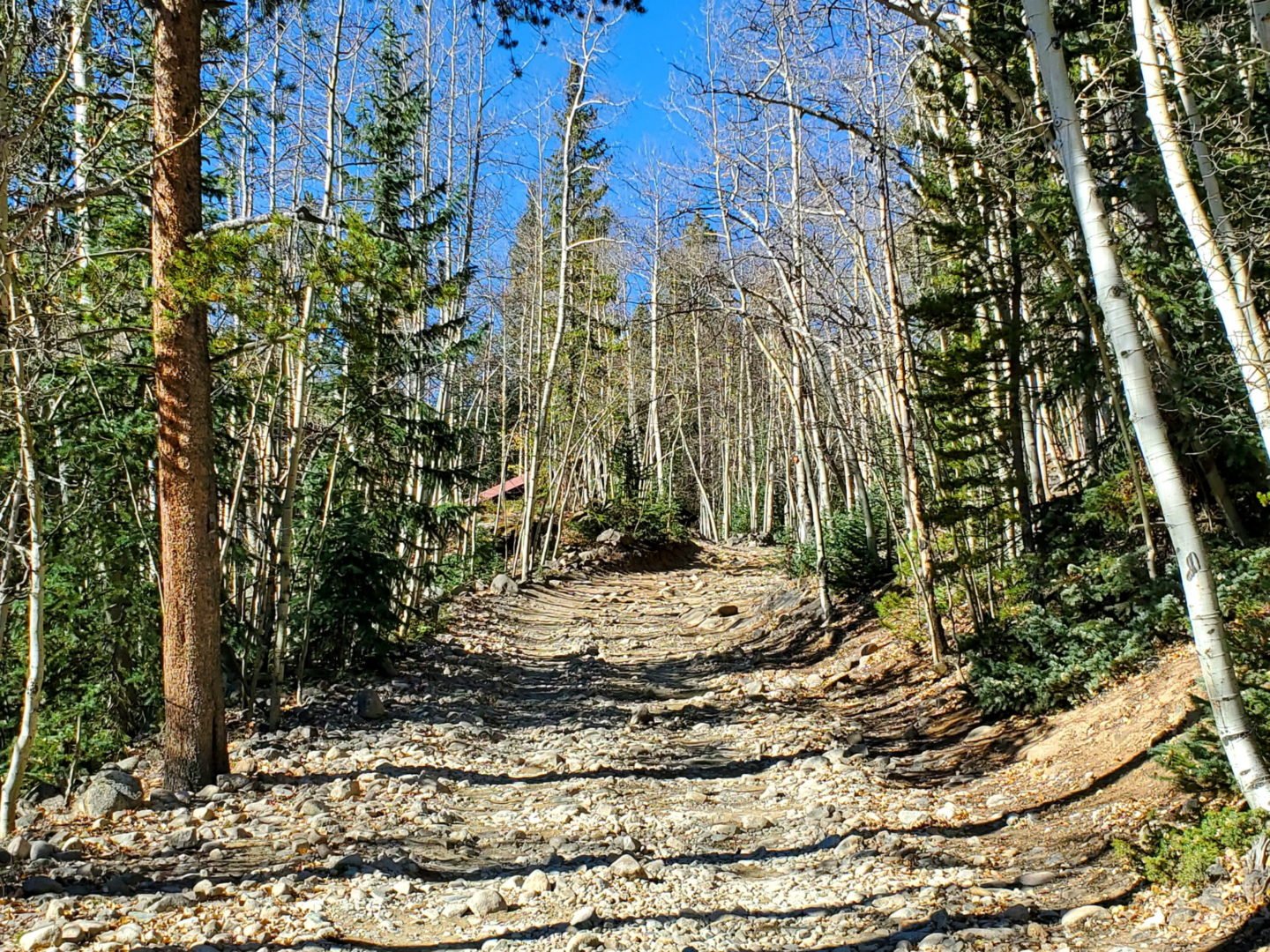
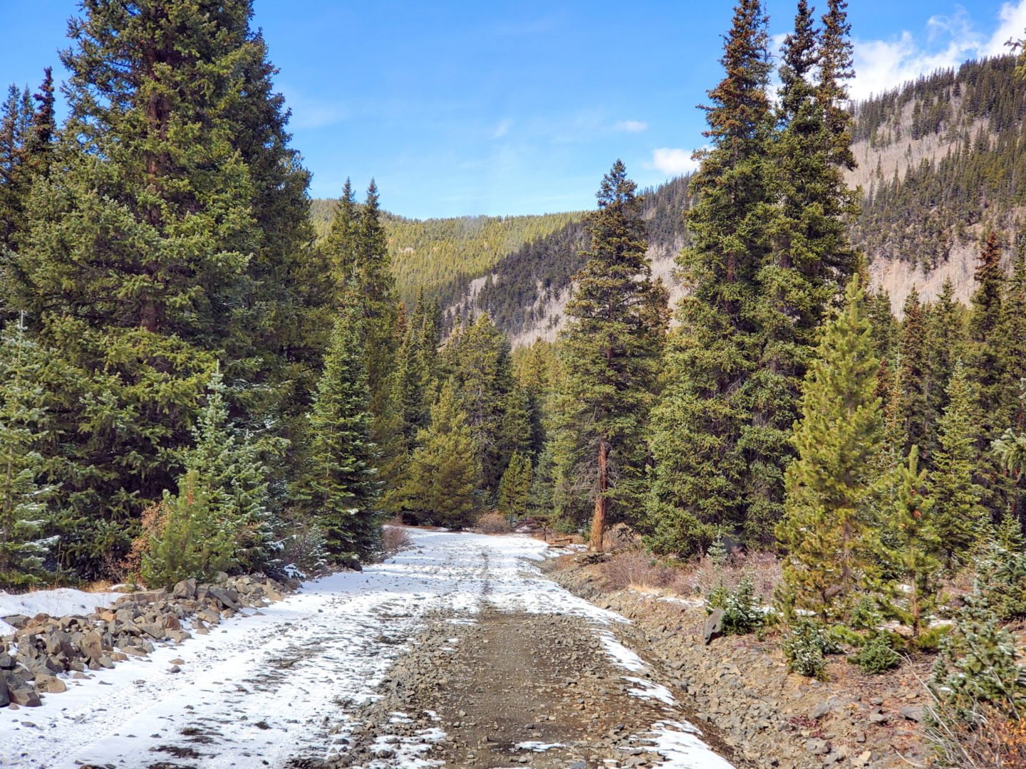
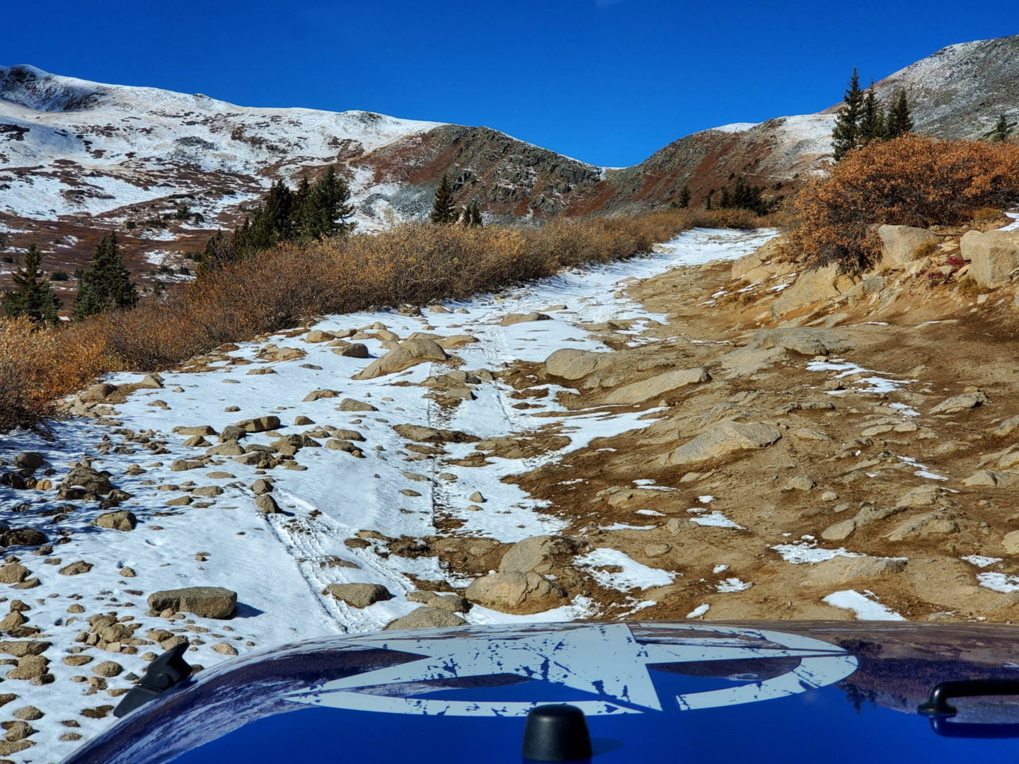
The road is very rough and rocky on the southeast side
The road is very rough and rocky on the southeast side
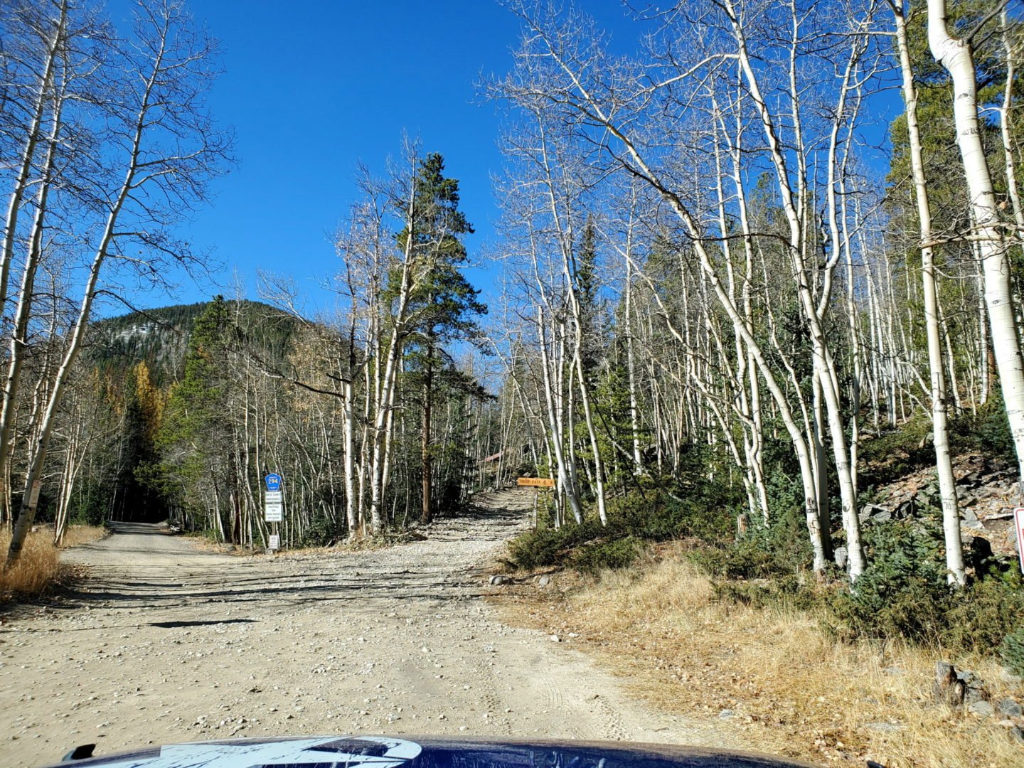
Stay right to start climbing to Tincup Pass
Stay right to start climbing to Tincup Pass
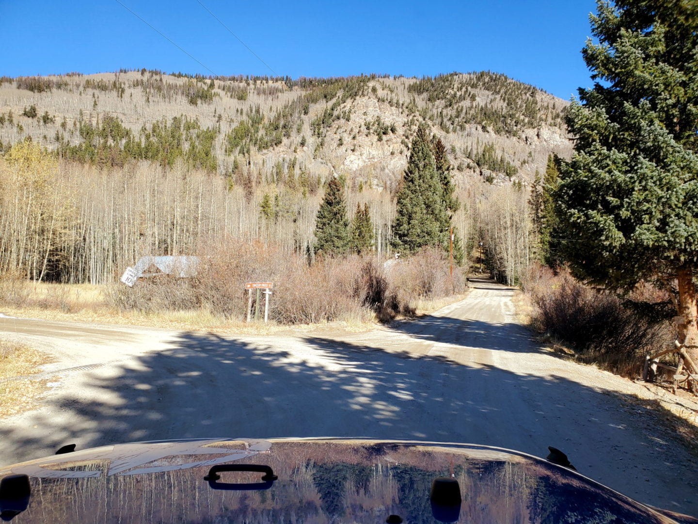
At the next intersection in St Elmo make a left
At the next intersection in St Elmo make a left
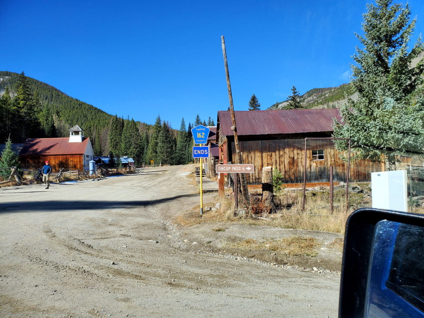
At the first junction in St Elmo, make a right
At the first junction in St Elmo, make a right
GPS Route with Elevation
Video Tour
Trail Directions
Starting from the south side of the pass at St. Elmo, the 4WD road climbs west toward Tincup Pass following the North Fork of Chalk Creek.
After 4 miles the road climbs to the north toward Tincup Pass.
Another mile in brings you to treeline with a good view of the remainder of the route to the pass. The switchbacks ahead are very narrow.
Once up the ledge road and switchbacks you will be at Tincup Pass, about 6 miles from St. Elmo.
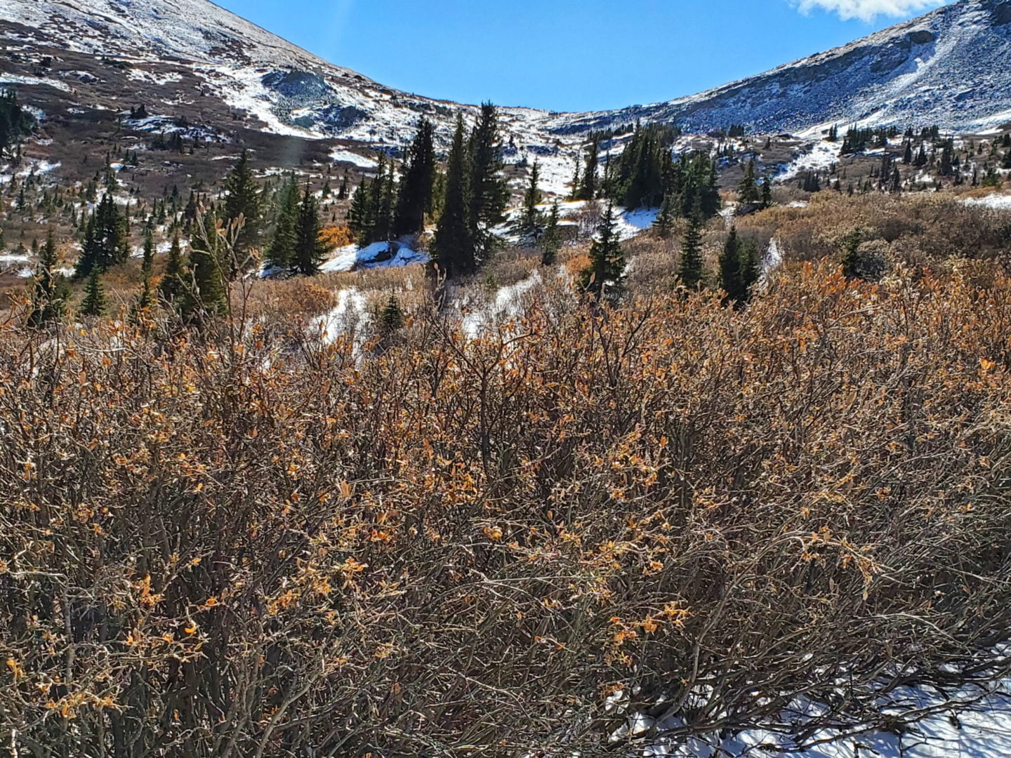
Heading down the north side of the pass, the road is rough for the first mile while it winds through the tundra.
The road gradually widens and becomes more maintained.
After crossing a creek you will drive on a section of road made up of large talus along the edge of Mirror Lake. This section is rough so use caution.
Once past the lake the road becomes passable by passenger vehicles.
Trailhead Directions
Hello Mike,
In September 2020 we had an amazing month’s long adventure in the Colorado Sawatch & San Juan Mountains. We live at sea level on the Outer Banks NC and although we are life long hikers, had never hiked at Colorado altitudes. After covid cancelled out EBC trip, we reached out to Mike and he worked with us to tailor an astounding trip with a mixture of challenging OHV and mountain summits. We were able to safely acclimatize and make the most of every day, sunrise to sunset. Our adventures included Owl Creek Pass, Silver Jack, Yankee Boy Basin, Blue Lakes, Cinnamon Pass, American Basin, Handies Peak, Mount Antero, Hagerman Tunnel Trail, Tin Cup Pass, The Continental Divide, and Lake Ann. These ranges offer the most peaceful beautiful country, the views just don’t stop. Thank you so much Mike for inspiring us, providing the perfect plan, and sharing your knowledge of these beautiful mountain ranges. We’re planning to return again this fall. Take good care.