Colorado Mountain Ranges

Colorado is home to the Southern Rockies and is the only U.S. state that lies entirely above 3,000′ (1,000 meters) in elevation. The ranges of the Southern Rockies are higher than those of the Middle or Northern Rockies, with many peaks exceeding elevations of 14,000 feet. 

Colorado has more than 50 peaks over this elevation, the highest being Mt Elbert in the Sawatch Range, which at 14,433 feet (4,399 m), is the highest point in the 3,000 mile long Rockies. 

  • The highest elevation mountain range in Colorado is the Sawatch Range, which has 15 peaks over 14,000 feet.
  • The largest mountain range by area on Colorado is the San Juan Range, extending north to south 150 miles from Ouray, Colorado to Chama, New Mexico. East to west the range runs 180 miles from Cortez, Colorado to Monte Vista, Colorado
  • The longest mountain range in Colorado is the Front Range, which spans 180 miles from north to south

Highest Point Mt. Elbert at 14,440′ (4,401 m) in elevation, is in the Sawatch Range. Mt Elbert is also the highest point in the Rocky Mountains of North America.

Lowest Point – 3,317′ (1,011 m) on the eastern boundary of Yuma County, where the Arikaree River flows into the state of Kansas, on the eastern plains.

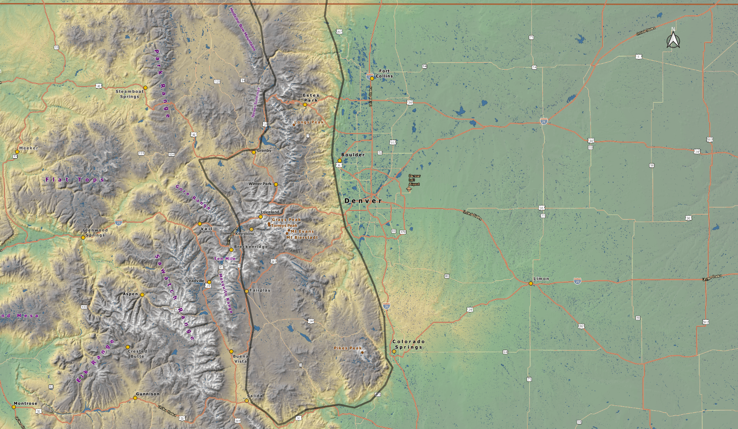
Colorado Mountain Range Map

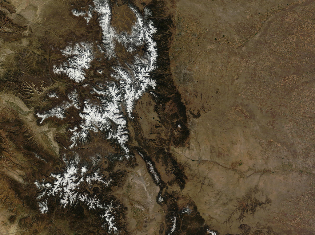
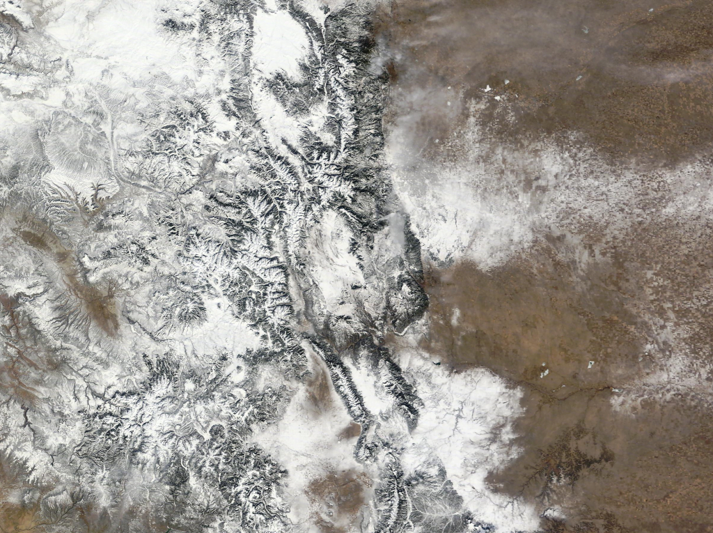
    Typical Seasonal Snow Cover

    Colorado mountains

    Summer

    Colorado mountains

    Fall

    Colorado mountains

    Winter

    Colorado mountains

    Spring

    Front Range Mountains

    The Front Range is the longest mountain range in Colorado, stretching approximately 180 miles north-south between Cheyenne, Wyoming and Pueblo, Colorado. From east to west, the Front Range is roughly 97 miles across. When traveling west across the Great Plains, the Front Range will be the first mountain range you encounter.

    Highest Point: Grays Peak (14,278′), also the highest peak on the Continental Divide.

    Composition: Gneiss, Schist, and Granite

    Colorado mountains

    Front Range Trails

    Naylor, Silver Dollar, and Murray Lake (12,200′)

    The trail features three lakes: Naylor Lake (11,378'), Silver Dollar Lake...

    Lost Lake (9,850′), Front Range

    Lost Lake is an alpine lake surrounded by the majestic mountains of the...

    Mt Flora (13,146′), Front Range

    Located within the James Peak Wilderness area, this hike offers a well...

    Arapaho Pass (11,950′), Front Range

    From the east, access to Arapaho Pass can be found along a rough 2WD road...

    Lake Haiyaha (10,244′), Front Range

    Lake Haiyaha is a secluded, boulder-riddled lake in lower Chaos Canyon....

    Argentine Pass (13,207′), Front Range

    Argentine Pass is the highest named vehicle-accessible pass in Colorado....

    Rollins Pass (11,671′), Front Range

    Rollins Pass is located on the Continental Divide, approximately five...

    Mt Ida (12,880′), Front Range

    The Mt Ida trail, at Milner Pass, is one of Rocky Mountain Park's most...

    Bierstadt Lake (9,470′), Front Range

    Bierstadt Lake sits atop a forested moraine, which is a ridge composed of...

    Mt Sniktau (13,234′), Front Range

    Mount Sniktau sits just east of the Continental Divide on the Front Range...

    Lake Isabelle (10,910′), Front Range

    Lake Isabelle lies hidden in a high, isolated bowl-shaped basin at the...

    Estes Cone (11,007′), Front Range

    Estes Cone is located about 3 miles from the Longs Peak trailhead on the...

    Pikes Peak (14,109′), Front Range

    Pikes Peak is the highest summit of the southern Front Range of the Rocky...

    Blodgett Peak (9,429′), Front Range

    Blodgett Peak is located in Blodgett Peak Open Space along the Rampart...

    Pancake Rocks (11,060′), Front Range

    Pancake Rocks Trail shares the trailhead used to reach Horsethief Falls...

    Mt Audubon (13,223′), Front Range

    Mt Audubon is the highest peak in the Indian Peaks Wilderness that has an...

    Shelf Road (9,494′), Fourmile Canyon

    Shelf Road Gold Belt Tour National Scenic Byway is a dirt road passable...

    Fremont Peak (7,273′), Royal Gorge

    Fremont Peak is the high point along a narrow ridge of hills rising near...

    The Crags (10,856′), Front Range

    The Crags Trail #664 follows Four Mile Creek through deep forests and...

    Hallett Peak (12,713′), Front Range

    Hallett Peak, viewed from east Rocky Mountain National Park, is...

    Lake Helene (10,630′), Front Range

    There is no signage and you must follow a social trail to get to the lake, but despite it’s obscurity, Lake Helene is a spectacular destination.

    Garden of the Gods (6,400′) Front Range

    Garden of the Gods is a geologically unique 480 acre park, having one of...

    Mills Lake (9,965′) & Jewel Lake (9,990′), Front Range

    Located within Glacier Gorge in Rocky Mountain National Park, Mills and...

    Crater Lake (10,400′) and Mirror Lake (10,325′), Front Range

    Mirror Lake and Crater lake are found deep in the heart of the Indian...

    Almagre Mountain (12,360′), Front Range

    Almagre Mountain (Mt Baldy) is the only other peak, besides Pikes Peak,...

    Mt Rosa (11,500′), Front Range

    Mt Rosa is located in the Pike National Forest just south of Pikes Peak...

    Mitchell and Blue Lake (11,360′), Front Range

    Mitchell and Blue Lake are located in the Brainard Lake Recreation Area,...

    Cheyenne Mountain (9,565′), Front Range

    Cheyenne Mountain's is a triple peak mountain with the geological summit...

    Mt Herman (9,104′), Front Range

    Mt Herman is the highest point on the Palmer Divide, just west of...

    Longs Peak (14,259′), Front Range

    Iconic Longs Peak (14,259') is the highest mountain in Rocky Mountain...

    Mt Blue Sky (14,268′), Front Range

    Mt Blue Sky can be accessed via the highest paved road in North America,...

    St Vrain Mountain Trail (12,162′), Front Range

    The St Vrain Mountain trail is located just outside the border of the...

    Flattop Mountain (12,332′), Front Range

    Flattop Mountain is located just east of the Continental Divide in Rocky...

    Carpenter Peak (7,166′), Front Range

    Carpenter Peak is located in Ro​xborough State Park,​ which is a Colorado...

    Devils Head Fire Lookout (9,748′), Front Range

    Devils Head Lookout was the last of the seven original Front Range...

    Spruce Mountain (7,635′), Front Range

    Spruce Mountain is located on the Palmer Divide, on the eastern fringe of...

    Sky Pond (10,900′), Front Range

    Sky Pond, located in Rocky Mountain National Park, is fed by Taylor...

    Twin Sisters (11,428′), Front Range

    The Twin Sisters ridge runs nearly two miles along the east central...

    Alberta Falls (9,400′), Front Range

    Alberta Falls, located in Glacier Gorge, is one of the more popular...

    Mt Morrison (7,881′), Front Range

    Mt Morrison stands above Red Rocks park, home of the famous Red Rocks...

    Grays(14,275) and Torreys(14,272) Peak, Front Range

    Grays and Torreys Peak are the two highest points on the Continental...

    Mt Bierstadt (14,066′), Front Range

    Mount Bierstadt is a 14,066-foot-high (4,287 m) mountain summit in the...

    Sawatch Mountain Range

    Extending southeastward for 100 miles (160 km) from the Eagle River to the city of Saguache, the Sawatch Range contains 15 peaks topping 14,000 feet (4,267 m), also known as 14er’s. The range forms a portion of the Continental Divide, and it’s mountains are high, massive, and relatively gentle in contour.

    Highest Point: Mt Elbert (14,433′), the highest peak in the Rocky Mountains.

    Composition: Granite, sandstone, quartzite, shale, gneiss, gabbro

    Colorado mountains

    Sawatch Mountain Range Trails

    Tincup Pass (12,154′), Sawatch Range

    Tincup Pass gets its name from prospector Jim Taylor, who in 1860 brought his gold strike back to camp in his tin cup. The pass was used to move supplies between St. Elmo and the town of Tin Cup starting in 1881, when a wagon road was built. The views and hiking...

    Mt Antero Rd (13,800′) , Sawatch Range

    Mt Antero is one of only a handful of 14,000' peaks that has a road that travels to within a short distance of the summit.  The road up the mountain is difficult, rough and rocky, requiring four-wheel drive, eventually topping out at 13,800'. From the end of the road...

    La Plata Peak (14,344′), Sawatch Range

    La Plata Peak is known for it's distinctive Ellingwood Ridge, and is one of the highest 14,000' peaks in Colorado. Traverseing the Southwest Ridge route, with Huron Peak and the Three Apostles providing a backdrop, makes for stunning scenery.  "La Plata" is Spanish...

    Huron Peak (14,006′), Sawatch Range

    Huron Peak is known as one of the most beautiful hikes in the Sawatch Mountain Range of Colorado. It is the most remote peak in the range, located within the San Isabel Nation Forest, and offers views of wilderness in every direction from it's small summit. It's not...

    La Plata Peak (14,344′), Sawatch Range

    La Plata Peak, in the middle of the Sawatch Range, is known for it's distinctive Ellingwood Ridge, popular among climbers. The Northwest Ridge trail starts from Highway 82 and follows the northern ridge that divides the La Plata basin from La Plata Gulch. There are...

    Missouri Mountain (14,071′), Sawatch Range

    At 14,067 feet, Missouri Mountain is the 36th highest peak in Colorado. It is located in the Sawatch Range of the Rocky Mountains, and is part of the Collegiate Peaks Wilderness. With eight "14ers" (peaks exceeding 14,000' in elevation), the Collegiate Peaks...

    Mt Elbert (14,438′), Sawatch Range

    Mt Elbert is the highest peak in the 3,000 mile long Rocky Mountains, a mountain chain which stretches from Canada to Mexico. The peak is situated near the small town and lakes of the same name, Twin Lakes. Despite it's size. the peak is a Class 1 hike, making it a...

    San Juan Mountain Range

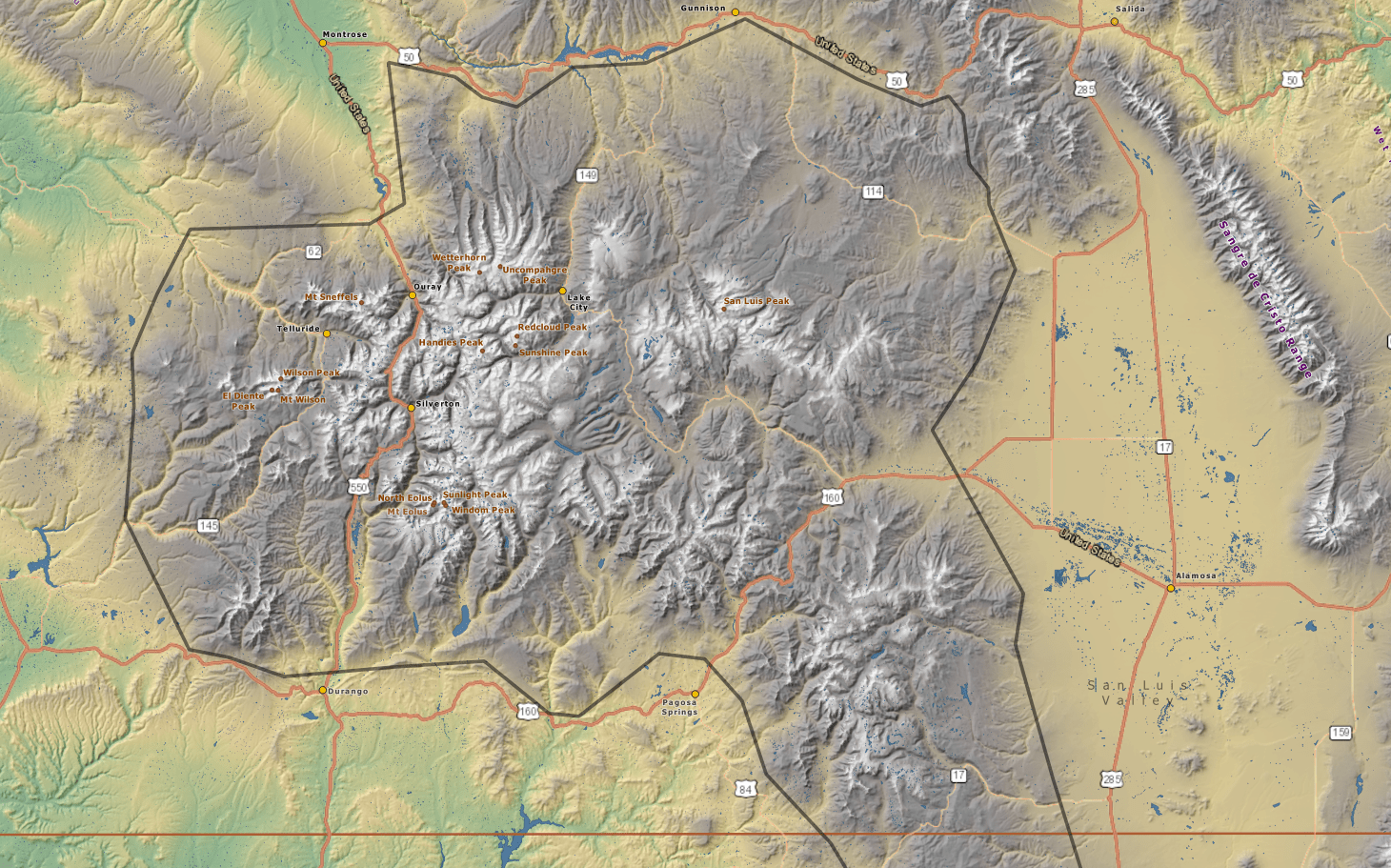
    The San Juan Mountains, in the southern Rockies, extends southeastward for 150 mi (240 km) from Ouray in southwestern Colorado, along the course of the Rio Grande, to the Chama River in northern New Mexico. It is the largest mountain range by area in Colorado. Volcanic rocks in the San Juan Mountains constitute the largest erosional remnant of a once nearly continuous volcanic field that extended over much of the southern Rocky Mountains and adjacent areas in Oligocene and later time.

    My personal opinion is that this is the most beautiful part of the state. If I could get away, I would be there today.

    Highest Point: Uncompahgre Peak (14,309′)
    Composition: Sandstone, shale, limestone, ash-flow tuff, quartz latitic lava, andesitic lava

    Colorado mountains

    San Juan Mountain Range Trails

    Handies Peak (14,058′), San Juan Range

    Handies Peak, which rises to 14,048 feet in elevation, is the highest point of land managed by the Bureau of Land Management. Among Colorado’s 14ers, Handies Peak is considered one of the more straightforward climbs, although getting to American Basin can be a...

    Wager Gulch (12,350′), San Juan Range

    The road up Wager Gulch (high-clearance 4-wheel drive vehicle recommended), leads to the remnants of the abandoned mining town of Carson, on the way up to the Continental Divide and beyond. Founded in 1889, Carson reached its peak at the turn of the century when some...

    Alpine Loop (12,800′), San Juan Range

    The Alpine Loop Backcountry Byway is a rugged 4x4 road that winds through the spectacular scenery of the San Juan Mountains, connecting Lake City, Silverton, and Ouray. The loop traverses passes up to 12,800 feet while showcasing old mines, ghost towns, natural...

    Potato Lake (9,800′), San Juan Range

    Spud Lake Trail #661 to Potato Lake is beautiful and short, with minimal elevation gain, making this an extremely popular hike. Passing through aspen glades, it offers excellent views of Engineer Mountain, Grayrock Peak, and Spud Mountain, along with good views of the...

    Stony Pass (12,592′), San Juan Range

    Stony Pass Rd crosses the Continental Divide and follows small streams that make up the headwaters of the Rio Grande River. The road was created in 1872 to connect the area’s mining operations in Silverton to the town of Del Norte. The Continental Divide Trail crosses...

    Hurricane Pass (12,730′) and California Pass (12,960′), San Juan Range

    The National Water and Climate Center reported that the SWE (snow water equivalent) for the San Juan Mountains, including Hurricane Pass and California Pass, in May of 2019 was 728% above normal. It was such a heavy snow year that most of the back country at higher...

    Mt Sneffels (14,155′), San Juan Range

    Mt Sneffels is the second highest summit in the San Juan mountains and known as the "Queen of the San Juans". Mt Sneffels is situated in the Mt Sneffels Wilderness of the Uncompahgre National Forest. There are only 15 miles of constructed trails in the 16,587 acre...

    American Basin to Sloan Lake (12,920′), San Juan Range

    The Handies Peak trail to Sloan Lake meanders through American Basin, one of the most scenic basins in the San Juan Mountains. The destination, Sloan Lake, is a high alpine lake above treeline near the base of American Peak in the basin. The trail continues past the...

    Mosquito & Ten Mile Mountain Range

    The Mosquito/Ten Mile range is a single range, but the part of it south of the Continental Divide is called the Mosquito Range, and the part north of the Divide is called the Ten Mile Range.

    The range consists of faulted anticlines formed as part of the Sawatch Uplift during the Laramide orogeny, approximately 65 million years ago. The mountains were originally contiguous with the higher Sawatch Range to the west, but were separated during the formation of the rift valley at the headwaters of the Arkansas River, approximately 35 million years ago.

    Highest Point: Mt. Lincoln (14,286 ft)
    Composition: granite, schist, quartzite

    Colorado mountains

    Mosquito/Ten Mile Mountain Range Trails

    Mosquito Pass (13,185′), Mosquito Range

    Mosquito Pass was built to connect the towns of Alma to the east, with Leadville to the west. It is the highest crossable vehicle mountain pass in the U.S. outside of Alaska. While there are higher vehicle passes, they are all out and back. The trail crosses the...

    Quandary Peak (14,272′), Ten Mile Range

    Quandary Peak is the only 14,000' peak in the Ten Mile Range. The summit provides great views of other nearby peaks such as Northstar Mountain, Mt. Lincoln, Mt. Cameron, Mt. Democrat, and Mt Bross to the south. To the north you see Pacific and Crystal Peak, as well as...

    Mt Sherman (14,043′), Mosquito Range

    In the middle of the Mosquito Range lies Mt Sherman, rising above the western edge of South Park, in central Colorado. The peak is named for the Union General William Tecumseh Sherman, who served under General Ulysses S. Grant during the Civil War. Keep in mind that...

    Mt Democrat (14,154′) , Mt Cameron (14,248′), Mt Lincoln (14,293′), and Mt Bross (14,178), Mosquito Range

    DeCaliBron" (Mt Democrat, Mt Cameron, Mt Lincoln, Mt Bross) provides an opportunity to summit four 14,000' peaks in one day. The linkup involves a fairly steep hike up Mt. Democrat, followed by a prolonged walk along several ridges. The technical difficulty on this...

    Sangre de Cristo Mountain Range

    The Sangre de Cristo Mountains are fault-block mountains similar to the Teton Range in Wyoming and the Wasatch Range in Utah. There are major fault lines running along both the east and west sides of the range and, in places, cutting through the range. Like all fault block mountain ranges, the Sangre de Cristo’s lack foothills, which means the highest peaks rise abruptly from the valleys to the east and west, over 7,000 feet in only a few miles in some places. The mountains were pushed up around 5 million years ago as one large mass of rock. The Sangre de Cristo range is still being uplifted today as faults in the area remain active.

    Highest Point: Blanca Peak (14,351′)
    Composition: gneiss, sandstone, limestone, dolomite

    Colorado mountains

    Sangre de Cristo Mountain Range Trails

    Star Dune (8,617′), Great Sand Dunes N.P.

    The Great Sand Dunes National Park in Colorado is home to the tallest sand dunes in North America, reaching heights of up to 750 feet at Star Dune. Some interesting facts about Star Dune: 1. The Star Dune is the tallest dune in the park, standing at a height of 755...

    Music Pass (11,450′), Sangre de Cristo Range

    Music Pass is a east/west pass across the southern Sangre de Cristo range connecting the Wet Valley in the east with the Great Sand Dunes National Park and Preserve on the western side. The road gets progressively worse as you near the trailhead, so without a high...

    Lily Lake (12,385′), Sangre de Cristo Range

    This trail is one of the more beautiful in the state with lots of bang for your buck.  The trail starts out at 10,400 feet, hiking in an beautiful valley surrounded by huge mountain scenery, and is virtually flat.   So if you don’t want to make the climb up to Lilly...

    Humboldt Peak (14,068′), Sangre de Cristo Range

    Humboldt Peak is part of the Crestones in the rugged Sangre de Cristo mountain range. The Crestones are a cluster of 14,000′ peaks comprising Crestone Peak, Crestone Needle, Kit Carson Peak, Challenger Point, Humboldt Peak, and Columbia Point. Humboldt Peak is the...

    Hayden Pass (10,709′), Sangre de Cristo Range

    Hayden Pass road crosses the Sangre de Cristo Mountains between Villa Grove in the west, and Coaldale to the east. The road is most challenging and scenic when started from Villa Grove, on the southwest side. With grades up to 20%, great views of the San Luis valley...

    West Spanish Peak (13,625′), Sangre de Cristo Range

    West Spanish Peak (13,625') and East Spanish Peak (12,684') have world class geological features that made the two peaks a National Natural Landmark in 1976 and designated as a Wilderness Area in 2000. The peaks rise 6,000 ft from the edge of the eastern plains, and...

    South Colony Lakes (12,000′), Sangre de Cristo Range

    The South Colony Basin lies in the heart of southern Colorado's Sangre de Cristo Range, home of the South Colony Lakes. Surrounded by Crestone Needle (14,197'), Humboldt Peak (14,064'), and Broken Hand Peak (13,573'), the basin is one of the most beautiful alpine...

    High Dune (8,700′), Great Sand Dunes N.P.

    The Great Sand Dunes National Park and Preserve contains the tallest sand dunes in North America, rising about 750 feet (230 m) from the floor of the San Luis Valley at the western base of the Sangre de Cristo Range. The dunes  cover about 19,000 acres (7,700 ha)....

    Zapata Falls (9,250′), Sangre de Cristo Range

    This popular short hike to Zapata Falls is located 3 miles south of the Great Sand Dunes National Park and Preserve, off of Highway 150. Simply driving to the trailhead provides an excellent view of the entire dune field and San Luis Valley. Drive (east) onto a rough...

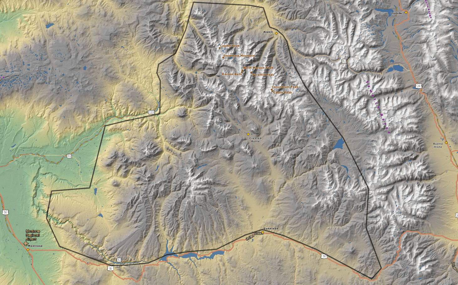
    Elk Mountain Range

    The mountains sit on the western side of the Continental Divide, largely in southern Pitkin and northern Gunnison counties, in the area southwest of Aspen, south of the Roaring Fork River valley, and east of the Crystal River. Much of the range is located within the White River and Gunnison National Forest, as well as the Maroon Bells-Snowmass Wilderness and Raggeds Wilderness. The Elk Mountains rise nearly 9,000 ft. above the Roaring Fork Valley to the north.

    Highest Point: Castle Peak (14,309′)
    Composition: Black shale, limestone, sandstone

    Colorado mountains

    Gore Mountain Range

    Colorado mountains

    The range runs approximately 60 miles (100 km) northwest-to-southeast forming the southern extension of the Park Range, extending southward from Rabbit Ears Pass (U.S. Highway 40) to the Eagle River near Vail. The Colorado River passes through the range at Gore Canyon. The ridges of the range are prominently visible on clear days from the summit of Trail Ridge Road in Rocky Mountain National Park, approximately 50 miles (80 km) to the east. The range is traversed at its southern and southwestern lower flanks by Interstate 70 from Silverthorne to Vail. Much of the range is located within the Arapaho and White River National Forests, and large portions are protected within the Eagles Nest Wilderness.

    Highest Point: Mt Powell (13,566′)
    Composition: sedimentary, volcanic

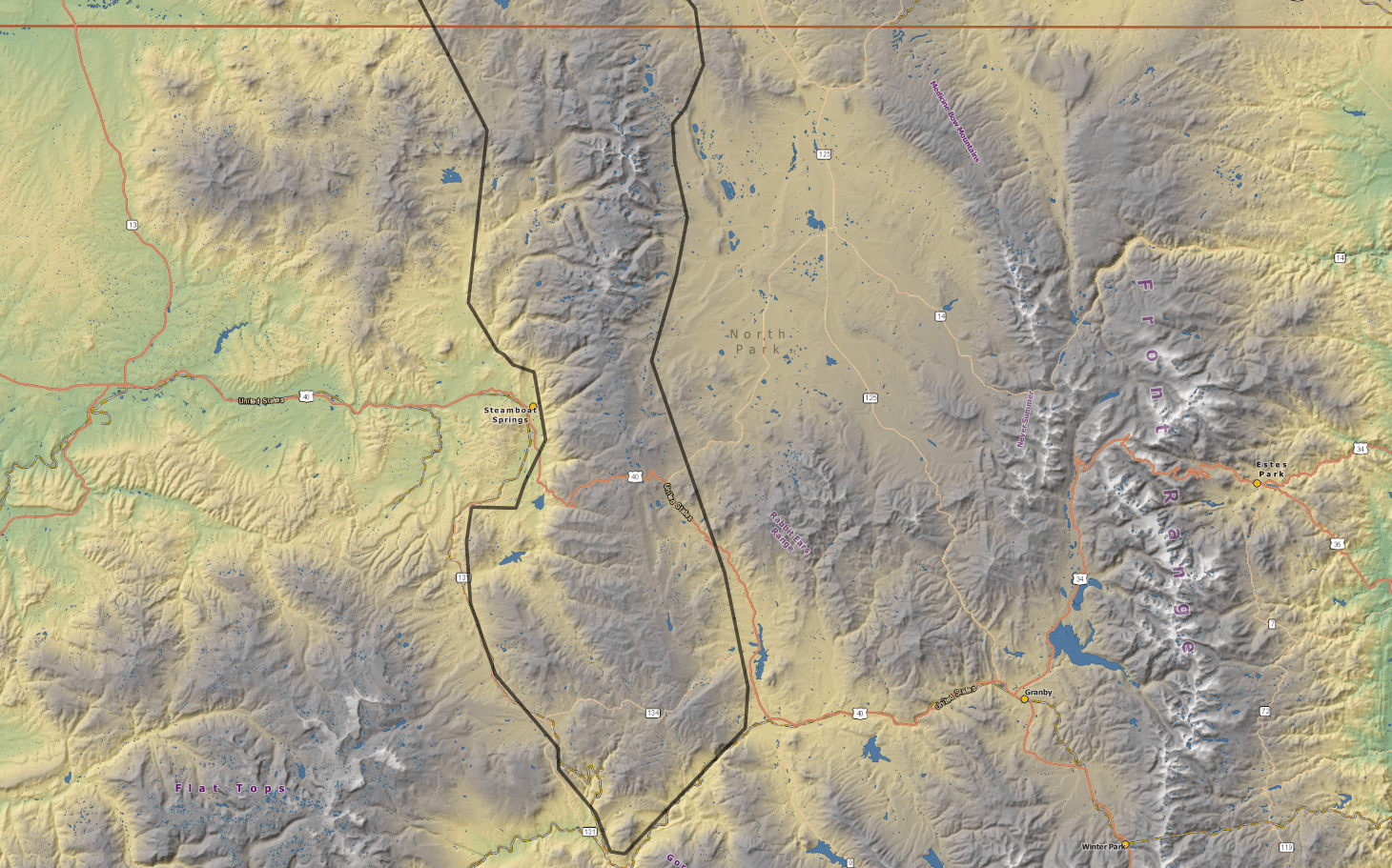
    Park Mountain Range

    The range forms a relatively isolated part of the Continental Divide, extending north-to-south for approximately 40 miles (64 km) along the boundary between Jackson (east) and Routt counties. It separates North Park in the upper basin of the North Platte River on the east from the Elk River basin in the watershed of the Yampa River the west.

    It rises steeply out of the Yampa River basin, forming a climatic barrier that receives heavy snowfall in winter. The northern end of the range lies in Wyoming and is known as the Sierra Madre Range.

    Steamboat Springs, a popular ski resort community, sits on the southwestern flank of the range, at the base of Mount Werner. Much of the range is located within the Routt National Forest. The range is prominently visible from both sides and forms a picturesque skyline from much of North Park. It is traversed at its southern end by Rabbit Ears Pass which lies along US 40. It is also traversed by Buffalo Pass via a gravel road between Steamboat Springs and Walden.

    The Park Range is the snowiest range in Colorado, receiving over 500 inches of snowfall a year.

    Highest Point: Mt Zirkel 12,182′
    Composition: sedimentary and volcanic rock – some of the oldest geology in the state – up to 1.8 billion years old

    Colorado mountains

    Park Mountain Range Trails

    Lower Fish Creek Falls (7,420′), Park Range

    Lower Fish Creek Falls is a 283' waterfall located about 5 miles to the east of Steamboat Springs, Colorado. There are two trails which provide great views of the falls. First is the Overlook, a 1/4 mile handicapped-friendly accessible trail, which is relatively flat....